|
search place name
|
||
Ramići (Federacija Bosne i Hercegovine, Bosnia and Herzegovina)Ramići is a town in the Federacija Bosne i Hercegovine region of Bosnia and Herzegovina. An overview map of the region around Ramići is displayed below.
regional and 3d topo map of Ramići, Bosnia and Herzegovina ::

Ramići airports ::
The nearest airport is ZAG - Zagreb, located 60.8 km north of Ramići.
Other airports nearby include RJK - Rijeka (103.5 km west), ZAD - Zadar (129.8 km south), MBX - Maribor (141.9 km north), LJU - Ljubliana Ljubljana (158.4 km north west), Nearby towns ::
Ikići (0.4km north east) //
Slatina (0.6km south east) //
Ponorac (1.0km south) //
Glavica (1.2km west) //
Paunovac (1.6km north west) //
Rajnovac (1.6km south east) //
Poljice (2.2km north) //
Drenovac (1.9km north east) //
Selište (1.9km south east) //
Hušidići (2.4km south west) //
Metla (2.3km south east) //
Polje (2.6km north west) //
Dizdarevići (2.3km south west) //
Debela Kosa (2.7km north east) //
Ifreti (3.1km south) //
Klupe (2.7km south west) //
Miljanovići (3.2km north west) //
Malobabići (2.9km north east) //
Grad (3.4km south) //
Kapići (3.3km south east) //
Poljana (2.6km east) //
Muratovac (2.8km west) //
Hegića Selo (3.2km south east) //
Lajša (2.7km east) //
Pecka (2.8km east) //
Crni Potok (3.5km north west) //
Orčeva Luka (4.0km south) //
Rizvići (3.2km south west) //
Bakići (3.9km north west) //
[all distances 'as the bird flies' and approximate] 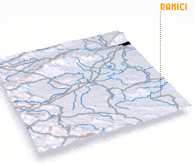 Places with similar names to Ramići, Bosnia and Herzegovina ::
Disclaimer :: Information on this page comes without warranty of any kind |
||
|
Where is Ramići? Elevation and coordinates ::
Latitude (lat): 45°12'39"N Longitude (lon): 15°53'18"E
Elevation (approx.): 171m (map arrows pan, magnifying glasses zoom) |
||
|
Visiting Ramići? Hotel/Accommodation ::
Book a hotel in Ramići Travel Guide ::
rental cars ::
car rental offers GPS waypoint ::
download a GPX waypoint (PoI) of Ramići for your GPS receiver
|
||