|
search place name
|
||
Vrbljani (Federacija Bosne i Hercegovine, Bosnia and Herzegovina)Vrbljani is a town in the Federacija Bosne i Hercegovine region of Bosnia and Herzegovina. An overview map of the region around Vrbljani is displayed below.
regional and 3d topo map of Vrbljani, Bosnia and Herzegovina ::

Vrbljani airports ::
The nearest airport is SJJ - Sarajevo, located 31.7 km north east of Vrbljani.
Other airports nearby include OMO - Mostar (48.0 km south), DBV - Dubrovnik (129.3 km south), SPU - Split (136.5 km west), TIV - Tivat (156.8 km south east), Nearby towns ::
Pirići (0.6km north east) //
Sinanovići (1.0km north west) //
Podorašac (1.2km south east) //
Podkanjina (1.9km south east) //
Kanjina (2.3km south east) //
Borovac (2.5km south) //
Bale (2.7km north) //
Čirat (2.2km south east) //
Homolje (3.1km south) //
Galjevo (3.4km south) //
Vinište (3.0km south west) //
Živašnica (3.5km south) //
Ugošće (2.6km west) //
Zukići (3.5km north east) //
Šunji (3.3km north east) //
Čovići (4.1km south) //
Zukići (3.6km north east) //
Jurići (4.0km south) //
Vjeternice (3.1km east) //
Ovčari (4.2km south) //
Brđani (3.1km east) //
Rosulje (3.2km east) //
Hasanovići (3.8km north west) //
Živanje (4.1km south east) //
Stari Grad (3.7km south east) //
Barmiš (3.6km north west) //
Rudenice (3.4km east) //
Gredina (4.9km south) //
Donje Selo (4.7km south west) //
[all distances 'as the bird flies' and approximate] 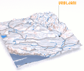 Places with similar names to Vrbljani, Bosnia and Herzegovina ::
// Vrbljene (SI)
Disclaimer :: Information on this page comes without warranty of any kind |
||
|
Where is Vrbljani? Elevation and coordinates ::
Latitude (lat): 43°42'18"N Longitude (lon): 17°58'26"E
Elevation (approx.): 625m (map arrows pan, magnifying glasses zoom) |
||
|
Visiting Vrbljani? Hotel/Accommodation ::
Book a hotel in Vrbljani Travel Guide ::
rental cars ::
car rental offers GPS waypoint ::
download a GPX waypoint (PoI) of Vrbljani for your GPS receiver
|
||