|
search place name
|
||
Vučići (Federacija Bosne i Hercegovine, Bosnia and Herzegovina)Vučići is a town in the Federacija Bosne i Hercegovine region of Bosnia and Herzegovina. An overview map of the region around Vučići is displayed below.
regional and 3d topo map of Vučići, Bosnia and Herzegovina ::

Vučići airports ::
The nearest airport is SJJ - Sarajevo, located 77.9 km south east of Vučići.
Other airports nearby include OMO - Mostar (101.8 km south), SPU - Split (117.3 km south west), OSI - Osijek (179.1 km north east), DBV - Dubrovnik (188.8 km south), Nearby towns ::
Fonjge (0.5km east) //
Ðulovići (0.6km east) //
Pobrđani (0.9km south) //
Rakite (0.9km north) //
Šahmani (1.5km south) //
Keže (1.2km south east) //
Korenići (1.4km south west) //
Dolovi (1.7km south east) //
Deveđari (1.7km north east) //
Selmani (1.6km south east) //
Vučići (2.0km north) //
Plisnići (1.7km west) //
Brdo (2.4km south) //
Petkovići (2.0km south east) //
Vlađevići (1.9km south west) //
Bašići (2.0km south west) //
Lađevići (2.4km south east) //
Sabljari (2.7km south) //
Kovijani (2.4km west) //
Milutini (3.1km north west) //
Mišinići (3.2km south east) //
Pinjo (3.0km north west) //
Janjići (3.2km north west) //
Nuhići (2.8km south east) //
Topola (3.4km north) //
Servani (3.6km south) //
Savanovići (3.7km north) //
Baškalo (3.1km north west) //
Maleševići (2.9km south west) //
[all distances 'as the bird flies' and approximate] 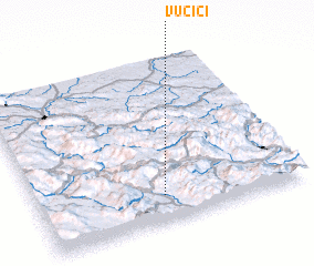 Places with similar names to Vučići, Bosnia and Herzegovina ::
Disclaimer :: Information on this page comes without warranty of any kind |
||
|
Where is Vučići? Elevation and coordinates ::
Latitude (lat): 44°9'35"N Longitude (lon): 17°28'42"E
Elevation (approx.): 863m (map arrows pan, magnifying glasses zoom) |
||
|
Visiting Vučići? Hotel/Accommodation ::
Book a hotel in Vučići Travel Guide ::
rental cars ::
car rental offers GPS waypoint ::
download a GPX waypoint (PoI) of Vučići for your GPS receiver
|
||