|
search place name
|
||
Al Abshīţ (Al Gharbīyah, Egypt)Al Abshīţ is a town in the Al Gharbīyah region of Egypt. An overview map of the region around Al Abshīţ is displayed below.
regional and 3d topo map of Al Abshīţ, Egypt ::

Al Abshīţ airports ::
The nearest airport is CAI - Cairo Intl, located 97.0 km south of Al Abshīţ.
Other airports nearby include ALY - Alexandria Intl (111.5 km west), PSD - Port Said (115.9 km east), Nearby towns ::
Dinūshar (1.2km east) //
Al ‘Āmirīyah (4.3km north) //
Ad Dawākhilīyah (3.8km north east) //
Al Hayātim (4.6km south) //
Kafr al ‘Abāʼidah (5.1km north) //
Bulqīnah (4.6km east) //
Mīt ash Shaykh (5.2km north west) //
Sijīn al Kawm (5.5km south west) //
Al Jābirīyah (5.8km north) //
Kafr al ‘Abāyidah (5.9km north) //
Minyat Shintinā ‘Ayyāsh (5.4km south east) //
Al Qirāţīyah (6.3km north) //
Samātāy (6.5km north west) //
`Ezbet el-Insha (7.2km north) //
Ibshawâi el-Malaq (6.3km west) //
Nishîl (6.4km west) //
Şafţ Turāb (7.3km south east) //
Maḩallat Rawḩ (8.2km south) //
Al Mu‘tamadīyah (8.3km north) //
Kunayyisat Damshīt (8.1km south west) //
Shubrā Malakān (7.3km east) //
‘Izbat al ‘Arab (8.0km north west) //
Sindsīs (8.5km north east) //
‘Izbat Māhir (8.7km north west) //
Kafr Damshīt (9.2km south west) //
Damshīt (9.7km south west) //
Diyarb Hāshim (9.3km north east) //
Mīt al Layth Hāshim (9.6km north east) //
[all distances 'as the bird flies' and approximate] 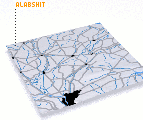 Places with similar names to Al Abshīţ, Egypt ::
// Al Bicht (YE)
Disclaimer :: Information on this page comes without warranty of any kind |
||
|
Where is Al Abshīţ? Elevation and coordinates ::
Latitude (lat): 30°57'8"N Longitude (lon): 31°5'10"E
Elevation (approx.): 11m (map arrows pan, magnifying glasses zoom) |
||
|
Visiting Al Abshīţ? Hotel/Accommodation ::
Book a hotel in Al Abshīţ Travel Guide ::
Buy a travel guide for Egypt rental cars ::
car rental offers GPS waypoint ::
download a GPX waypoint (PoI) of Al Abshīţ for your GPS receiver
|
||