|
search place name
|
||
Al Başalīyah Qiblī (Aswān, Egypt)Al Başalīyah Qiblī is a town in the Aswān region of Egypt. An overview map of the region around Al Başalīyah Qiblī is displayed below.
regional and 3d topo map of Al Başalīyah Qiblī, Egypt ::

Al Başalīyah Qiblī airports ::
The nearest airport is LXR - Luxor Intl, located 63.5 km north of Al Başalīyah Qiblī.
Other airports nearby include ASW - Aswan Intl (126.2 km south), Nearby towns ::
Naj‘ Hilāl (2.4km north east) //
Naj‘ al Hawwārī (3.0km north west) //
Al Ḩajz Qiblī (3.4km north) //
Al Maḩāmīd (3.8km north) //
Aş Şa‘āʼidah al Qiblī (4.7km south east) //
Ash Shaykh an Najjār Abū ‘Alī (5.2km north west) //
Al Kilḩ (5.3km south east) //
Al Kilḩ Sharq (5.4km east) //
Naj‘ al Mafālisah (5.7km east) //
Al Kilḩ Gharb (6.0km south east) //
Naj‘ ash Shaykh (6.0km north west) //
Naj‘ al Ma‘marīyah (6.8km north west) //
Naj‘ ash Shamākhīyah (7.6km north west) //
Al Ḩajz Baḩrī (7.8km north west) //
Naj‘ al Khawī (8.2km north west) //
Naj‘ al Karnak (8.5km south east) //
Al Başalīyah Baḩrī (9.2km north west) //
Naj‘ al Qārah (9.6km south east) //
Naj‘ al ‘Uwaynīyah (10.4km north west) //
[all distances 'as the bird flies' and approximate] 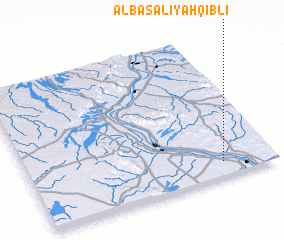 Places with similar names to Al Başalīyah Qiblī, Egypt :: Disclaimer :: Information on this page comes without warranty of any kind |
||
|
Where is Al Başalīyah Qiblī? Elevation and coordinates ::
Latitude (lat): 25°6'12"N Longitude (lon): 32°47'30"E
Elevation (approx.): 89m (map arrows pan, magnifying glasses zoom) |
||
|
Visiting Al Başalīyah Qiblī? Hotel/Accommodation ::
Book a hotel in Al Başalīyah Qiblī Travel Guide ::
Buy a travel guide for Egypt rental cars ::
car rental offers GPS waypoint ::
download a GPX waypoint (PoI) of Al Başalīyah Qiblī for your GPS receiver
|
||