|
search place name
|
||
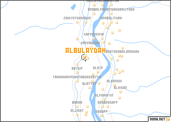
Al Bulaydah (Al Jīzah, Egypt)Al Bulaydah is a town in the Al Jīzah region of Egypt. An overview map of the region around Al Bulaydah is displayed below.
regional and 3d topo map of Al Bulaydah, Egypt ::
Al Bulaydah airports ::
The nearest airport is CAI - Cairo Intl, located 52.0 km north of Al Bulaydah.
Other airports nearby include PSD - Port Said (201.9 km north east), ALY - Alexandria Intl (209.0 km north west), Nearby towns ::
Bidsah (0.8km north east) //
Barnasht (1.2km north) //
Abū Ruwaysh (1.7km south west) //
Baydif (3.0km south west) //
Manshīyat Fāḑil (3.0km north east) //
Kafr aḑ Ḑab‘ī (3.3km north) //
Bahbīt (3.2km south east) //
Al ‘Aţf (3.4km south east) //
Al Misāndah (4.6km south) //
Ţahmā wa Minshāt ‘Abd as Sayyid (4.7km south) //
Kafr Ḩumayyid (5.1km north) //
Kafr ar Rifā‘ī (5.2km north) //
Nazlat ‘Ilyān (4.9km east) //
Al Jazīrah ash Shaqrāʼ (5.5km south east) //
Al Ikhşāş al Qiblīyah (5.4km north east) //
Al ‘Ayyāţ (5.9km south) //
Kafr Ţarkhān ash Sharqī (5.9km north east) //
Ghammāzah al Kubrá (5.9km north east) //
Sakanāt ‘Arab al ‘Ayāʼidah (6.0km east) //
‘Arab al ‘Abābdah (6.0km east) //
Al Ḩayy (6.2km south east) //
Ghammāzah aş Şughrá (6.2km east) //
Al Aqwāz (7.0km south east) //
Nazlat Sallām (7.0km south east) //
Sakanāt ‘Arab al ‘Arāʼiḑah (6.6km east) //
Sakanāt ‘Arab aţ Ţarrābīn wa al Mughāzī (6.6km east) //
Sakanāt ‘Arab al Ḩişār (6.9km east) //
‘Arab aţ Ţarabīn (7.1km east) //
Al Manshī (7.6km south east) //
[all distances 'as the bird flies' and approximate] 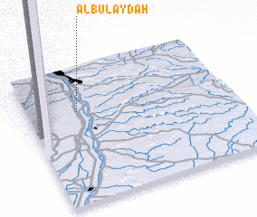 Places with similar names to Al Bulaydah, Egypt ::
// Al Balad (EG)
// Al Bulaydah (TN)
// Albolodúy (ES)
// Albolote (ES)
// Ālībāltā (IR)
// Al Bulţ (KW)
// Al Bilad (OM)
// Al Bulaydah (OM)
// Al Bulaydah (OM)
// Albelda (ES)
Disclaimer :: Information on this page comes without warranty of any kind |
||
|
Where is Al Bulaydah? Elevation and coordinates ::
Latitude (lat): 29°40'22"N Longitude (lon): 31°14'59"E
Elevation (approx.): 25m (map arrows pan, magnifying glasses zoom) |
||
|
Visiting Al Bulaydah? Hotel/Accommodation ::
Book a hotel in Al Bulaydah Travel Guide ::
Buy a travel guide for Egypt rental cars ::
car rental offers GPS waypoint ::
download a GPX waypoint (PoI) of Al Bulaydah for your GPS receiver
|
||