|
search place name
|
||
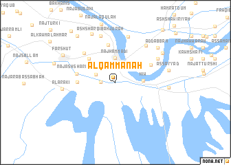
Al Qammānah (Qinā, Egypt)Al Qammānah is a town in the Qinā region of Egypt. An overview map of the region around Al Qammānah is displayed below.
regional and 3d topo map of Al Qammānah, Egypt ::
Al Qammānah airports ::
The nearest airport is LXR - Luxor Intl, located 60.5 km south east of Al Qammānah.
Other airports nearby include HRG - Hurghada Intl (201.9 km north east), Nearby towns ::
Naj‘ al Kalḩ (2.3km north) //
Al Gharbī Bahjūrah (2.2km west) //
‘Izbat Aḩmad Maḩmūd Jum‘ah (3.1km north west) //
Naj‘ Ḩammādī (4.0km north) //
Naj‘ an Nājḩīyah (4.2km north east) //
Hiw (4.1km east) //
Bahjūrah (5.4km north west) //
An Nujū‘ (5.5km west) //
Awlād Najm al Qiblīyah (6.2km north) //
Ar Raḩmānīyah Qiblī (5.9km north east) //
Naj‘ al Qināwīyah (5.9km north east) //
Naj‘ ash Sharqāwī (5.9km west) //
Naj‘ al Qubībah (6.6km north west) //
Al Gharbī bi as Salamīyah (7.7km north) //
As Salamīyah al Ḩāʼiţ (7.5km north east) //
Al Qaşr (7.2km north east) //
Ash Sharqī Bahjūrah (7.8km north) //
Madīnat Maşna‘ al Alūminyum (7.8km east) //
Al ‘Arakī (7.9km west) //
Awlād Nijm Bahjūrah (8.6km north west) //
Ad Dābbah (8.3km north east) //
Aş Şayyād (8.0km east) //
Al Qaşr wa aş Şayyād (8.3km north east) //
Farshūţ (8.8km north west) //
Al ‘Asīrāt (9.3km north west) //
Kawm al Bijāh (10.5km north west) //
‘Izbat al Būşah (10.9km north east) //
[all distances 'as the bird flies' and approximate]  Places with similar names to Al Qammānah, Egypt :: Disclaimer :: Information on this page comes without warranty of any kind |
||
|
Where is Al Qammānah? Elevation and coordinates ::
Latitude (lat): 26°0'57"N Longitude (lon): 32°14'19"E
Elevation (approx.): 71m (map arrows pan, magnifying glasses zoom) |
||
|
Visiting Al Qammānah? Hotel/Accommodation ::
Book a hotel in Al Qammānah Travel Guide ::
Buy a travel guide for Egypt rental cars ::
car rental offers GPS waypoint ::
download a GPX waypoint (PoI) of Al Qammānah for your GPS receiver
|
||