|
search place name
|
||
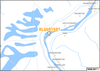
Al ‘Udaysāt (Qinā, Egypt)Al ‘Udaysāt is a town in the Qinā region of Egypt. An overview map of the region around Al ‘Udaysāt is displayed below.
regional and 3d topo map of Al ‘Udaysāt, Egypt ::
Al ‘Udaysāt airports ::
The nearest airport is LXR - Luxor Intl, located 24.4 km north east of Al ‘Udaysāt.
Other airports nearby include ASW - Aswan Intl (182.5 km south), HRG - Hurghada Intl (220.2 km north east), Nearby towns ::
Ar Ruzayqāt (1.7km west) //
Ad Dīmuqrāţ (2.5km south west) //
Ar Rayāyinah (2.5km north west) //
Wābūrat Armant (2.5km north east) //
Ţawd (5.0km east) //
Armant (6.2km north east) //
Ash Shaghab (7.6km south) //
Nazlat Armant (7.6km north east) //
[all distances 'as the bird flies' and approximate]  Places with similar names to Al ‘Udaysāt, Egypt ::
// Altaist (AT)
// Aldeşti (RO)
// Aldeşti (RO)
// Aldeşti (RO)
// Aldeşti (RO)
// Aldeşti (RO)
// Ali Dost (PK)
// Awlād Sa‘īd (LY)
// Awlād Sa‘īd (LY)
// Awlād Sa‘īd (EG)
Disclaimer :: Information on this page comes without warranty of any kind |
||
|
Where is Al ‘Udaysāt? Elevation and coordinates ::
Latitude (lat): 25°35'0"N Longitude (lon): 32°29'0"E
Elevation (approx.): 81m (map arrows pan, magnifying glasses zoom) |
||
|
Visiting Al ‘Udaysāt? Hotel/Accommodation ::
Book a hotel in Al ‘Udaysāt Travel Guide ::
Buy a travel guide for Egypt rental cars ::
car rental offers GPS waypoint ::
download a GPX waypoint (PoI) of Al ‘Udaysāt for your GPS receiver
|
||