|
search place name
|
||
Al Waḩḩāl (Kafr ash Shaykh, Egypt)Al Waḩḩāl is a town in the Kafr ash Shaykh region of Egypt. An overview map of the region around Al Waḩḩāl is displayed below.
regional and 3d topo map of Al Waḩḩāl, Egypt ::

Al Waḩḩāl airports ::
The nearest airport is ALY - Alexandria Intl, located 95.1 km west of Al Waḩḩāl.
Other airports nearby include PSD - Port Said (123.4 km east), CAI - Cairo Intl (131.4 km south), Nearby towns ::
‘Izbat Faraj (0.3km south east) //
Ar Riyāḑ (0.5km north west) //
‘Izbat ‘Alī ‘Abd al Muta‘āl (1.2km north west) //
‘Izbat al Baţţ (1.3km south) //
‘Izbat Dirbālah (1.4km south west) //
‘Izbat Ḩawḑ ash Sha‘īr (1.5km south east) //
Qaryat al Muthallath (1.8km north) //
‘Izbat an Nāḩiyatayn (1.5km west) //
‘Izbat al Makanah (2.1km north west) //
‘Izbat Khulayf (2.9km south) //
‘Izbat Bilāl (3.0km north) //
Qaryat ar Raghāmah (2.9km north east) //
Manshīyat Jād Allāh (2.8km south east) //
‘Izbat as Sinjābī (3.0km north west) //
‘Izbat Bakīr (3.1km south) //
Kawm Abū Rayyah (3.0km east) //
‘Izbat al Maşrī (3.6km south) //
‘Izbat al Hajīn (3.7km south) //
Minshāt Salāmah (3.7km south west) //
‘Izbat Faraj ash Shāmī (3.9km north) //
‘Izbat Maţar (3.5km west) //
‘Izbat Khayr Allāh (4.0km south east) //
‘Izbat Abū Shuḩaymah (3.7km south west) //
‘Izbat aḑ Ḑab‘ah (4.2km north west) //
‘Izbat Yūsuf Salāmah (4.6km north) //
‘Izbat Khalīfah Abū Ḩasan (4.6km south east) //
‘Izbat Muḩammad Abū as Sayyid (4.7km north) //
‘Izbat aţ Ţayyārah (4.6km south east) //
‘Izbat ad Dawwār (4.7km north east) //
[all distances 'as the bird flies' and approximate] 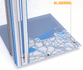 Places with similar names to Al Waḩḩāl, Egypt ::
Disclaimer :: Information on this page comes without warranty of any kind |
||
|
Where is Al Waḩḩāl? Elevation and coordinates ::
Latitude (lat): 31°14'18"N Longitude (lon): 30°56'42"E
Elevation (approx.): 6m (map arrows pan, magnifying glasses zoom) |
||
|
Visiting Al Waḩḩāl? Hotel/Accommodation ::
Book a hotel in Al Waḩḩāl Travel Guide ::
Buy a travel guide for Egypt rental cars ::
car rental offers GPS waypoint ::
download a GPX waypoint (PoI) of Al Waḩḩāl for your GPS receiver
|
||