|
search place name
|
||
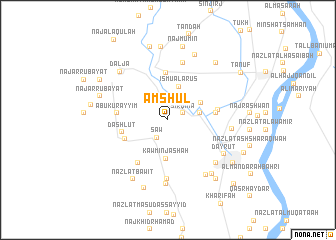
Amshūl (Asyūţ, Egypt)Amshūl is a town in the Asyūţ region of Egypt. An overview map of the region around Amshūl is displayed below.
regional and 3d topo map of Amshūl, Egypt ::
Amshūl airports ::
The nearest airport is LXR - Luxor Intl, located 288.5 km south east of Amshūl.
Nearby towns ::
Sirqinā (1.7km north east) //
Abū al Hīdr (2.3km north) //
Sāw (2.3km south west) //
Naj‘ Mubārak (3.0km north east) //
Zāwiyat Hārūn (3.0km north east) //
Nazlat Muşţafá Afandī (3.2km east) //
Ismū al ‘Arūs (3.9km north) //
Banī Ḩarām (3.8km north east) //
Kawm Injāshah (4.3km south) //
Nazlat Sāw (4.8km south west) //
Awlād Sarḩān (5.3km north) //
Dashlūţ (4.7km west) //
Nazlat Sirqinā (4.9km east) //
Naj‘ ash Shaykh Ḩasan Abū Şābir (4.9km east) //
An Naşirīyah (5.1km east) //
Naj‘ Shaykh al ‘Arab (5.1km west) //
Abū Kurayyim (5.1km west) //
Bāwīţ (5.7km south west) //
Naj‘ ‘Ammār (6.5km north) //
Naj‘ Muḩammad Ḩarīdī (6.5km north) //
Kudyat an Naşārá (6.6km south) //
Kawdiyat al Islām (7.1km south) //
Bānūb (6.8km south east) //
Dayrūţ ash Sharīf (6.5km east) //
Dayrūţ (6.7km south east) //
Biblāw wa Nazlat Badawī (7.2km south east) //
Daljāʼ (7.2km north west) //
Nazlat Bāwīţ (7.5km south west) //
Nazlat Faraj Maḩmūd (7.4km south east) //
[all distances 'as the bird flies' and approximate] 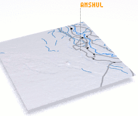 Places with similar names to Amshūl, Egypt ::
Disclaimer :: Information on this page comes without warranty of any kind |
||
|
Where is Amshūl? Elevation and coordinates ::
Latitude (lat): 27°35'35"N Longitude (lon): 30°45'5"E
Elevation (approx.): 49m (map arrows pan, magnifying glasses zoom) |
||
|
Visiting Amshūl? Hotel/Accommodation ::
Book a hotel in Amshūl Travel Guide ::
Buy a travel guide for Egypt rental cars ::
car rental offers GPS waypoint ::
download a GPX waypoint (PoI) of Amshūl for your GPS receiver
|
||