|
search place name
|
||
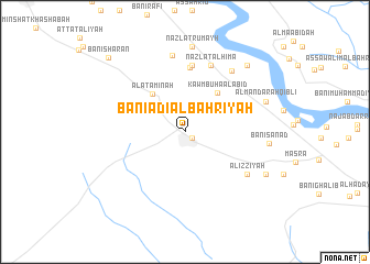
Banī ‘Adī al Baḩrīyah (Asyūţ, Egypt)Banī ‘Adī al Baḩrīyah is a town in the Asyūţ region of Egypt. An overview map of the region around Banī ‘Adī al Baḩrīyah is displayed below.
regional and 3d topo map of Banī ‘Adī al Baḩrīyah, Egypt ::
Banī ‘Adī al Baḩrīyah airports ::
The nearest airport is LXR - Luxor Intl, located 249.7 km south east of Banī ‘Adī al Baḩrīyah.
Nearby towns ::
Banī ‘Adī al Qiblīyah (0.9km south east) //
Al ‘Atāminah (4.8km north west) //
Kawm Būhā al ‘Abīd (4.9km north east) //
Banī Majd (6.5km north) //
Sarāwah (6.8km north) //
Nazlat al Ḩimāʼ (7.2km north) //
Al ‘Izzīyah (7.1km south east) //
Manfalūţ (7.5km north east) //
Nazzat Qarār (7.8km north) //
Banī Sanad (7.7km east) //
Nazlat Rumayḩ (8.7km north) //
Al Mandarah Qiblī (8.0km north east) //
Jaḩdam (8.5km south east) //
Jimrīs (8.8km north east) //
Banī Sha‘rān (10.2km north west) //
[all distances 'as the bird flies' and approximate] 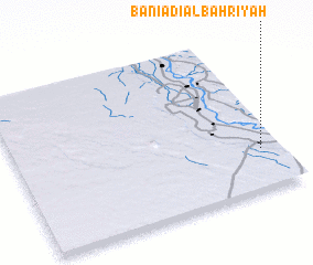 Places with similar names to Banī ‘Adī al Baḩrīyah, Egypt :: Disclaimer :: Information on this page comes without warranty of any kind |
||
|
Where is Banī ‘Adī al Baḩrīyah? Elevation and coordinates ::
Latitude (lat): 27°15'20"N Longitude (lon): 30°55'35"E
Elevation (approx.): 49m (map arrows pan, magnifying glasses zoom) |
||
|
Visiting Banī ‘Adī al Baḩrīyah? Hotel/Accommodation ::
Book a hotel in Banī ‘Adī al Baḩrīyah Travel Guide ::
Buy a travel guide for Egypt rental cars ::
car rental offers GPS waypoint ::
download a GPX waypoint (PoI) of Banī ‘Adī al Baḩrīyah for your GPS receiver
|
||