|
search place name
|
||
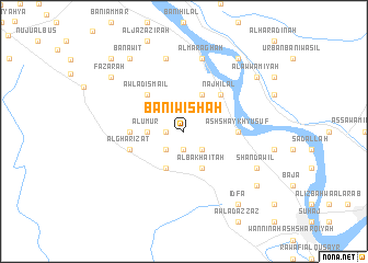
Banī Wishāḩ (Sūhāj, Egypt)Banī Wishāḩ is a town in the Sūhāj region of Egypt. An overview map of the region around Banī Wishāḩ is displayed below.
regional and 3d topo map of Banī Wishāḩ, Egypt ::
Banī Wishāḩ airports ::
The nearest airport is LXR - Luxor Intl, located 154.9 km south east of Banī Wishāḩ.
Nearby towns ::
Al Buţākh (1.7km west) //
Bihtah (1.9km south) //
Al Waqdah (2.5km south west) //
Bahālīl al Jazīrah (2.5km south east) //
Al ‘Umūr (3.3km west) //
Abū ‘Azīz (4.1km south west) //
Al Bakhāʼitah (4.1km south east) //
Banī Zār (4.1km south east) //
Bāşūnah (4.1km north east) //
Awlād Ismā‘īl (5.0km north west) //
Naj‘ Hilāl (5.0km north east) //
Iqşāş (5.0km north east) //
Ash Shaykh Yūsuf (5.0km east) //
As Samārinah (5.0km west) //
Al Gharīzāt (5.3km west) //
Ash Shaykh Shibl (7.6km north) //
Al Marāghah (7.6km north) //
Shandawīl (7.6km south east) //
Fazārah (8.6km north west) //
Idfā (8.9km south east) //
Al Ḩammādīyah (8.7km south east) //
Banāwīţ (8.9km north west) //
Fazārah bi al Qaryah (8.9km north west) //
Al ‘Awwāmīyah (8.6km north east) //
Al Kitkātah (8.9km north east) //
Al Qurayyah (9.9km north west) //
[all distances 'as the bird flies' and approximate] 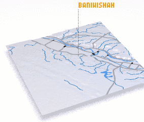 Places with similar names to Banī Wishāḩ, Egypt :: Disclaimer :: Information on this page comes without warranty of any kind |
||
|
Where is Banī Wishāḩ? Elevation and coordinates ::
Latitude (lat): 26°38'0"N Longitude (lon): 31°35'0"E
Elevation (approx.): 61m (map arrows pan, magnifying glasses zoom) |
||
|
Visiting Banī Wishāḩ? Hotel/Accommodation ::
Book a hotel in Banī Wishāḩ Travel Guide ::
Buy a travel guide for Egypt rental cars ::
car rental offers GPS waypoint ::
download a GPX waypoint (PoI) of Banī Wishāḩ for your GPS receiver
|
||