|
search place name
|
||
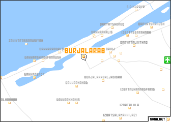
Burj al ‘Arab (Al Iskandarīyah, Egypt)Burj al ‘Arab is a town in the Al Iskandarīyah region of Egypt. An overview map of the region around Burj al ‘Arab is displayed below.
regional and 3d topo map of Burj al ‘Arab, Egypt ::
Burj al ‘Arab airports ::
The nearest airport is ALY - Alexandria Intl, located 49.5 km north east of Burj al ‘Arab.
Other airports nearby include CAI - Cairo Intl (200.1 km south east), Nearby towns ::
Dawwār Siwākah (2.4km north east) //
Zāwiyat al Habbābīyah (3.2km east) //
Dawwār Ibrāhīm Abū Shunaywīr (3.7km north west) //
Naj‘ ‘Azzām (5.6km north) //
Burj al ‘Arab al Jadīdah (5.5km south east) //
Dawwār ‘Abd al Qādir Qāsim (5.1km west) //
Bahīj (5.1km east) //
Dawwār Ḩamad (5.8km south) //
Dawwār Abū Maḩrūs (5.8km north) //
Naj‘ al Jūr (5.5km east) //
Dawwār Ḩalīs (6.4km north east) //
Zāwiyat al ‘Asīlah (6.4km east) //
Qaryat Bahīj (6.9km east) //
Qaryat Shurūq (8.9km north east) //
[all distances 'as the bird flies' and approximate] 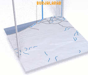 Places with similar names to Burj al ‘Arab, Egypt :: Disclaimer :: Information on this page comes without warranty of any kind |
||
|
Where is Burj al ‘Arab? Elevation and coordinates ::
Latitude (lat): 30°55'0"N Longitude (lon): 29°32'0"E
Elevation (approx.): 17m (map arrows pan, magnifying glasses zoom) |
||
|
Visiting Burj al ‘Arab? Hotel/Accommodation ::
Book a hotel in Burj al ‘Arab Travel Guide ::
Buy a travel guide for Egypt rental cars ::
car rental offers GPS waypoint ::
download a GPX waypoint (PoI) of Burj al ‘Arab for your GPS receiver
|
||