|
search place name
|
||
‘Izbat Abū an Naşr al Fār (Kafr ash Shaykh, Egypt)‘Izbat Abū an Naşr al Fār is a town in the Kafr ash Shaykh region of Egypt. An overview map of the region around ‘Izbat Abū an Naşr al Fār is displayed below.
regional and 3d topo map of ‘Izbat Abū an Naşr al Fār, Egypt ::

‘Izbat Abū an Naşr al Fār airports ::
The nearest airport is ALY - Alexandria Intl, located 62.4 km west of ‘Izbat Abū an Naşr al Fār.
Other airports nearby include CAI - Cairo Intl (142.1 km south east), PSD - Port Said (156.1 km east), Nearby towns ::
Qabrīţ (1.8km west) //
As Sālimīyah (2.3km south west) //
‘IzbatYūsuf Ḩabīb (2.1km east) //
‘Izbat az Zawāmil (2.4km north east) //
‘Izbat Makram (2.8km north) //
‘Izbat ‘Abd al Fattāḩ ‘Alī (3.1km south west) //
‘Izbat Abū Dirāz (3.2km north east) //
Kafr as Sūdān (3.1km south east) //
Al Lawīyah (3.5km south) //
Minyat al Ashrāf (3.1km west) //
‘Izbat al Khūlī (3.3km east) //
‘Izbat al Manshīyah (3.8km north west) //
Surunbāy (3.6km west) //
Kafr ash Shaykh Ḩasan (4.4km south) //
Kafr al ‘Ilwī (4.1km west) //
‘Izbat Mursī al Mallāḩ (4.3km south east) //
‘Izbat al Ḩalwānī (4.7km north east) //
‘Izbat al Hawānim (4.7km north east) //
‘Izbat al Milḩayn (4.6km south east) //
Maḩallat Mālik (5.2km south) //
‘Izbat as Siljā (5.5km north) //
Shabās al Milḩ (4.8km east) //
‘Izbat Mukhtār Ḩusayn (5.5km north) //
‘Izbat al Mişrī (5.1km north east) //
‘Izbat Fāţimah Hānim (5.4km south east) //
‘Izbat ‘Alī al Mallāḩ (5.3km south east) //
‘Izbat Kāmil al Wakīl (5.7km south east) //
‘Izbat al Wazīr (6.1km north) //
Sumukhrāţ (6.1km south) //
[all distances 'as the bird flies' and approximate] 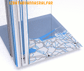 Places with similar names to ‘Izbat Abū an Naşr al Fār, Egypt :: Disclaimer :: Information on this page comes without warranty of any kind |
||
|
Where is ‘Izbat Abū an Naşr al Fār? Elevation and coordinates ::
Latitude (lat): 31°12'1"N Longitude (lon): 30°36'13"E
Elevation (approx.): 3m (map arrows pan, magnifying glasses zoom) |
||
|
Visiting ‘Izbat Abū an Naşr al Fār? Hotel/Accommodation ::
Book a hotel in ‘Izbat Abū an Naşr al Fār Travel Guide ::
Buy a travel guide for Egypt rental cars ::
car rental offers GPS waypoint ::
download a GPX waypoint (PoI) of ‘Izbat Abū an Naşr al Fār for your GPS receiver
|
||