|
search place name
|
||
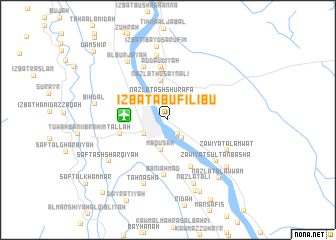
‘Izbat Abū Filībū (Al Minyā, Egypt)‘Izbat Abū Filībū is a town in the Al Minyā region of Egypt. An overview map of the region around ‘Izbat Abū Filībū is displayed below.
regional and 3d topo map of ‘Izbat Abū Filībū, Egypt ::
Nearby towns ::
Nazlat al Ḩājir (1.8km south east) //
Sawādah (2.4km south east) //
Nazlat ash Shurafāʼ (2.7km north) //
Kafr al Manşūrah al Qiblī (2.8km south west) //
Al Ikhşāş (3.2km north west) //
Damārīs (3.2km north west) //
Māqūsah (3.4km south) //
Al Minyā (3.8km north west) //
Nazlat Ḩusayn ‘Alī (4.4km north) //
Nazlat ad Dāwūdīyah (5.6km north) //
Tallah (5.0km west) //
Nazlat Banī Aḩmad ash Sharqīyah (5.7km south east) //
Ad Dāʼūdīyah (5.9km north) //
Banī Aḩmad (6.2km south) //
Nazlat Faraj Allāh Mattá (6.3km north) //
Zāwiyat Sulţān Bashā (6.6km south east) //
Al Ḩawārtah (7.2km north) //
Zāwiyat al Amwāt (6.8km south east) //
Nazlat ‘Alī (7.6km south) //
Ţahnashā (7.6km south) //
Al Burjāyah (7.6km north west) //
Şafţ ash Sharqīyah (7.5km south west) //
‘Izbat ‘Ibayd Şārūfīm (8.3km north) //
Bihdāl (7.4km west) //
Al Ḩawāşilīyah (8.3km south) //
Nazlat al ‘Asākir (7.9km south east) //
Nazlat al ‘Awwām (8.2km south east) //
Al Maţāhrah al Baḩarīyah (8.6km south) //
Dimshāw Hāshim (10.4km south west) //
[all distances 'as the bird flies' and approximate]  Places with similar names to ‘Izbat Abū Filībū, Egypt ::
// ‘Izbat Abū Ghallāb (EG)
Disclaimer :: Information on this page comes without warranty of any kind |
||
|
Where is ‘Izbat Abū Filībū? Elevation and coordinates ::
Latitude (lat): 28°5'50"N Longitude (lon): 30°46'25"E
Elevation (approx.): 46m (map arrows pan, magnifying glasses zoom) |
||
|
Visiting ‘Izbat Abū Filībū? Hotel/Accommodation ::
Book a hotel in ‘Izbat Abū Filībū Travel Guide ::
Buy a travel guide for Egypt rental cars ::
car rental offers GPS waypoint ::
download a GPX waypoint (PoI) of ‘Izbat Abū Filībū for your GPS receiver
|
||