|
search place name
|
||
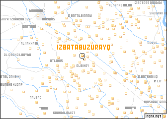
‘Izbat Abū Zurayq (Al Buḩayrah, Egypt)‘Izbat Abū Zurayq is a town in the Al Buḩayrah region of Egypt. An overview map of the region around ‘Izbat Abū Zurayq is displayed below.
regional and 3d topo map of ‘Izbat Abū Zurayq, Egypt ::
‘Izbat Abū Zurayq airports ::
The nearest airport is ALY - Alexandria Intl, located 63.9 km north west of ‘Izbat Abū Zurayq.
Other airports nearby include CAI - Cairo Intl (122.2 km south east), PSD - Port Said (164.7 km east), Nearby towns ::
Jinbāwāy (0.2km east) //
Tilbānah (1.0km south west) //
Ad Daramallīyah (1.0km north east) //
‘Izbat al Wābūr (1.9km north east) //
Şafţ al Mulūk (2.0km south east) //
Ar Rawaqah (2.0km north west) //
Al Bihay (2.5km south) //
‘Izbat Atharīyāt Fāz̧il (2.6km south) //
‘Izbat ad Daramallī al Baḩarīyah (2.4km south west) //
‘Izbat Aḩmad Farghalī (2.4km south east) //
‘Izbat Shubrā an Nūnah ash Sharqīyah (2.5km south west) //
‘Izbat al ‘Allāyah (2.7km south east) //
‘Izbat as Sālimīyah (3.1km south) //
Al Ibrāhīmīyah (2.8km north east) //
‘Izbat ad Daramallī al Qiblīyah (2.9km south west) //
‘Izbat Şināwī ash Sharqīyah (3.2km north east) //
‘Izbat al ‘Afīr (3.5km south east) //
‘Izbat Mabrūk Shinnāwī (3.6km south west) //
Al ‘Awjāʼ (3.6km north west) //
Dinshāl (3.6km north west) //
Shubrā an Nūnah (3.9km south) //
‘Izbat Ismā‘īl ‘Abd al Qādir (3.5km south west) //
‘Izbat Maḩmūd ash Shinnāwī (3.7km south west) //
‘Izbat Sayyid Aḩmad ash Shinnāwī (3.8km south west) //
‘Izbat Barānis al Ḩajar (3.5km west) //
‘Izbat ar Ruqayyiq (3.9km south) //
‘Izbat Aḩmad Ghazāl (4.1km north east) //
‘Izbat al Hilālīyah (4.3km south) //
‘Izbat aş Şayyād (4.4km north) //
[all distances 'as the bird flies' and approximate] 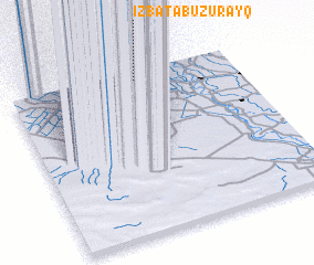 Places with similar names to ‘Izbat Abū Zurayq, Egypt :: Disclaimer :: Information on this page comes without warranty of any kind |
||
|
Where is ‘Izbat Abū Zurayq? Elevation and coordinates ::
Latitude (lat): 30°56'40"N Longitude (lon): 30°33'30"E
Elevation (approx.): 6m (map arrows pan, magnifying glasses zoom) |
||
|
Visiting ‘Izbat Abū Zurayq? Hotel/Accommodation ::
Book a hotel in ‘Izbat Abū Zurayq Travel Guide ::
Buy a travel guide for Egypt rental cars ::
car rental offers GPS waypoint ::
download a GPX waypoint (PoI) of ‘Izbat Abū Zurayq for your GPS receiver
|
||