|
search place name
|
||
‘Izbat Ibrāhīm ‘Abd al Hādī (Ad Daqahlīyah, Egypt)‘Izbat Ibrāhīm ‘Abd al Hādī is a town in the Ad Daqahlīyah region of Egypt. An overview map of the region around ‘Izbat Ibrāhīm ‘Abd al Hādī is displayed below.
regional and 3d topo map of ‘Izbat Ibrāhīm ‘Abd al Hādī, Egypt ::

‘Izbat Ibrāhīm ‘Abd al Hādī airports ::
The nearest airport is PSD - Port Said, located 61.2 km north east of ‘Izbat Ibrāhīm ‘Abd al Hādī.
Other airports nearby include CAI - Cairo Intl (102.5 km south), ALY - Alexandria Intl (165.7 km west), Nearby towns ::
‘Izbat Najib Jāb Allāh (0.5km east) //
Al Manshīyah (0.8km east) //
‘Izbat Kāmil Shalabī (1.5km east) //
‘Izbat ‘Alī Shawqī (2.3km west) //
Manshīyat Şiddīq (2.3km south east) //
Minshaʼat Muşbiḩ (2.7km south west) //
‘Izbat Aḩmad Ḩasanayn (2.6km west) //
Banī ‘Ubayd (2.7km west) //
Banī ‘Ubayd (2.9km west) //
‘Izbat an Nahḑah al Jadīdah (3.7km north) //
‘Izbat Shammās (3.2km east) //
‘Izbat al Muşādrah (3.4km east) //
‘Izbat Ḩāmid Nūr (3.7km north east) //
‘Izbat as Simbāwī (3.9km west) //
‘Izbat Ḩasanayn Ţantāwī (4.1km north west) //
‘Izbat ash Shalābwah (4.7km south east) //
‘Izbat al Bāz (4.4km south east) //
‘Izbat Na‘īm ‘Alī Hindī (4.8km north east) //
Aş Şalāḩāt (4.7km west) //
‘Izbat Muḩammad Ţanţāwī (5.1km north east) //
Mît Ṭarîf (5.5km north) //
‘Izbat al Ḩinnāwī (5.9km north) //
‘Izbat at Tall (5.9km north) //
Kafr aş Şalāḩāt (5.4km west) //
Qaşşāşīn al Azhār (5.6km south east) //
‘Izbat ash Shaykh Muḩammad (6.3km north) //
Diyarb al Khuḑr (6.2km north west) //
‘Izbat Abū ‘Abdūn (6.5km south east) //
‘Izbat Maz̧lūm (5.9km west) //
[all distances 'as the bird flies' and approximate] 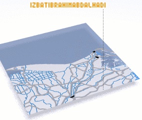 Places with similar names to ‘Izbat Ibrāhīm ‘Abd al Hādī, Egypt :: Disclaimer :: Information on this page comes without warranty of any kind |
||
|
Where is ‘Izbat Ibrāhīm ‘Abd al Hādī? Elevation and coordinates ::
Latitude (lat): 31°1'0"N Longitude (lon): 31°40'30"E
Elevation (approx.): 4m (map arrows pan, magnifying glasses zoom) |
||
|
Visiting ‘Izbat Ibrāhīm ‘Abd al Hādī? Hotel/Accommodation ::
Book a hotel in ‘Izbat Ibrāhīm ‘Abd al Hādī Travel Guide ::
Buy a travel guide for Egypt rental cars ::
car rental offers GPS waypoint ::
download a GPX waypoint (PoI) of ‘Izbat Ibrāhīm ‘Abd al Hādī for your GPS receiver
|
||