|
search place name
|
||
Nazlat ‘Abd aş Şālḩīn ‘Allāj (Al Minyā, Egypt)Nazlat ‘Abd aş Şālḩīn ‘Allāj is a town in the Al Minyā region of Egypt. An overview map of the region around Nazlat ‘Abd aş Şālḩīn ‘Allāj is displayed below.
regional and 3d topo map of Nazlat ‘Abd aş Şālḩīn ‘Allāj, Egypt ::

Nazlat ‘Abd aş Şālḩīn ‘Allāj airports ::
The nearest airport is CAI - Cairo Intl, located 222.1 km north of Nazlat ‘Abd aş Şālḩīn ‘Allāj.
Nearby towns ::
‘Izbat al Mashārqah (1.6km east) //
Al ‘Azīmah (Nimrah Khamsah) (2.9km west) //
Manshīyat ash Shiray‘ī (3.6km south east) //
Nazlat Hārūn (4.0km south east) //
Aţ Ţayyibah (4.2km north east) //
‘Izbat al Yamāmah (4.6km south east) //
‘Izbat al Qamādīr (4.6km east) //
Banī Ghanī (4.9km east) //
Nazlat Shādī (5.6km south east) //
Banī Samraj (6.4km south east) //
‘Izbat Şāliḩ Bāsil (6.9km south) //
Banī al Ḩakam (6.2km east) //
Būjah (6.6km south east) //
Shūshah (7.2km north east) //
Ash Shaykh ‘Abd Allāh (7.0km north east) //
Ḩasan Bāshā (8.1km south east) //
Nuqţat Raḩīl (8.7km south) //
Nazlat al ‘Amūdayn (7.9km east) //
Mahdīyah (9.0km south east) //
Dayr Samālūţ (9.2km north east) //
Hihyā (9.6km south east) //
[all distances 'as the bird flies' and approximate] 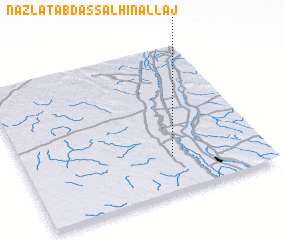 Places with similar names to Nazlat ‘Abd aş Şālḩīn ‘Allāj, Egypt :: Disclaimer :: Information on this page comes without warranty of any kind |
||
|
Where is Nazlat ‘Abd aş Şālḩīn ‘Allāj? Elevation and coordinates ::
Latitude (lat): 28°14'30"N Longitude (lon): 30°37'2"E
Elevation (approx.): 40m (map arrows pan, magnifying glasses zoom) |
||
|
Visiting Nazlat ‘Abd aş Şālḩīn ‘Allāj? Hotel/Accommodation ::
Book a hotel in Nazlat ‘Abd aş Şālḩīn ‘Allāj Travel Guide ::
Buy a travel guide for Egypt rental cars ::
car rental offers GPS waypoint ::
download a GPX waypoint (PoI) of Nazlat ‘Abd aş Şālḩīn ‘Allāj for your GPS receiver
|
||