|
search place name
|
||
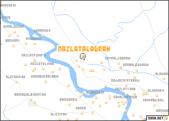
Nazlat al ‘Adrah (Asyūţ, Egypt)Nazlat al ‘Adrah is a town in the Asyūţ region of Egypt. An overview map of the region around Nazlat al ‘Adrah is displayed below.
regional and 3d topo map of Nazlat al ‘Adrah, Egypt ::
Nazlat al ‘Adrah airports ::
The nearest airport is LXR - Luxor Intl, located 248.5 km south east of Nazlat al ‘Adrah.
Nearby towns ::
Al Ma‘ābidah (1.0km north west) //
Nazlat Sulaymān al Ḩājj ‘Aţāʼ Allāh (1.6km west) //
Shaqalqīl (1.7km south west) //
Ash Shanābilah (2.0km south) //
Kawm Manşūrah (2.6km south east) //
Nazlat al Ḩarajāt (2.7km south east) //
‘Arab al ‘Aţīyāt al Baḩrīyah (3.3km east) //
As Sawālim al Baḩrīyah (4.3km south east) //
Jimrīs (5.3km west) //
Al Mandarah Qiblī (6.4km south west) //
Al Ḩawātikah (6.7km south) //
Banī Muḩammadīyāt (6.9km south east) //
Al Jāwlī (7.5km south) //
Manfalūţ (6.8km west) //
Dayr al Jabrāwī (6.7km east) //
Sukkarah (7.9km south) //
Naj‘ Kawm Bisāw (7.3km east) //
Nazlat Ḩammām Aḩmad (7.3km east) //
Al Ḩassānī (8.5km south) //
Naj‘ ‘Abd ar Rasūl (9.3km south east) //
Kawm Būhā al ‘Abīd (9.0km south west) //
Naj‘ Thābit (9.7km south east) //
[all distances 'as the bird flies' and approximate] 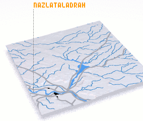 Places with similar names to Nazlat al ‘Adrah, Egypt ::
// Nazlet Aulâd Dura (EG)
Disclaimer :: Information on this page comes without warranty of any kind |
||
|
Where is Nazlat al ‘Adrah? Elevation and coordinates ::
Latitude (lat): 27°20'0"N Longitude (lon): 31°2'0"E
Elevation (approx.): 49m (map arrows pan, magnifying glasses zoom) |
||
|
Visiting Nazlat al ‘Adrah? Hotel/Accommodation ::
Book a hotel in Nazlat al ‘Adrah Travel Guide ::
Buy a travel guide for Egypt rental cars ::
car rental offers GPS waypoint ::
download a GPX waypoint (PoI) of Nazlat al ‘Adrah for your GPS receiver
|
||