|
search place name
|
||
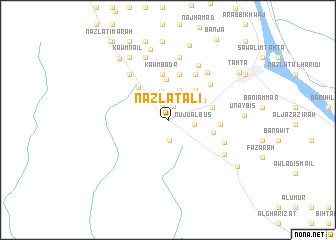
Nazlat ‘Alī (Sūhāj, Egypt)Nazlat ‘Alī is a town in the Sūhāj region of Egypt. An overview map of the region around Nazlat ‘Alī is displayed below.
regional and 3d topo map of Nazlat ‘Alī, Egypt ::
Nazlat ‘Alī airports ::
The nearest airport is LXR - Luxor Intl, located 173.2 km south east of Nazlat ‘Alī.
Nearby towns ::
Nazlat Yaḩyá (1.5km north) //
Naj‘ Abū Laylah (1.6km north) //
Qaryat ‘Alī Bin Abī Ţālib (2.3km south) //
Nuju‘ al Būş (2.7km east) //
Al Jubayrāt (3.2km north) //
Nag` Khalîfa (3.4km north) //
Nazlat Abū Raʼs (4.3km north east) //
Naj‘ Idrīs (4.1km north east) //
Al Kawm al Aşfar (4.5km north) //
Nazlat al Qāḑī (4.7km north west) //
Aţ Ţalīḩāt (4.6km east) //
Kawm Badr (5.1km north) //
Aş Şawāliḩ (5.2km north) //
Nazzat al Muḩazzimīn (4.7km east) //
Al Ḩarāfishah (5.3km east) //
Al Ḩarīdīyah al Baḩrīyah (5.8km north east) //
Al Ḩarīdīyah al Qiblīyah (5.8km north east) //
Al Qubayşāt (5.8km north east) //
Al Kawm al Aḩmar (6.4km north west) //
Nazzah (6.2km south east) //
Al Ḩarīdīyah (6.6km north east) //
Ash Shaykh Mas‘ūd (6.8km north east) //
Nazlat Ḩāmid (7.0km north) //
Nazlat ash Shaykh Ḩammād (7.3km north) //
Nazlat Musallam (7.3km north) //
Nazlat Naşr (7.3km north) //
Nazlat ‘Abbādah (7.3km north) //
Nazzat al Ḩājir (6.8km south east) //
Aş Şufayḩah (8.1km north) //
[all distances 'as the bird flies' and approximate] 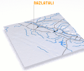 Places with similar names to Nazlat ‘Alī, Egypt ::
// Nazlat ‘Alī (EG)
Disclaimer :: Information on this page comes without warranty of any kind |
||
|
Where is Nazlat ‘Alī? Elevation and coordinates ::
Latitude (lat): 26°43'15"N Longitude (lon): 31°25'20"E
Elevation (approx.): 63m (map arrows pan, magnifying glasses zoom) |
||
|
Visiting Nazlat ‘Alī? Hotel/Accommodation ::
Book a hotel in Nazlat ‘Alī Travel Guide ::
Buy a travel guide for Egypt rental cars ::
car rental offers GPS waypoint ::
download a GPX waypoint (PoI) of Nazlat ‘Alī for your GPS receiver
|
||