|
search place name
|
||
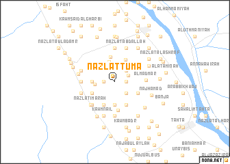
Nazlat Tūmā (Sūhāj, Egypt)Nazlat Tūmā is a town in the Sūhāj region of Egypt. An overview map of the region around Nazlat Tūmā is displayed below.
regional and 3d topo map of Nazlat Tūmā, Egypt ::
Nazlat Tūmā airports ::
The nearest airport is LXR - Luxor Intl, located 183.4 km south east of Nazlat Tūmā.
Nearby towns ::
Al Ḩallāqī (1.2km north west) //
Tell el-Zawaki (1.7km west) //
Kawm al Ḩāmiḑ (1.7km east) //
Kawm Ishqâw (2.3km north east) //
Nazlat Manşūr (2.5km south east) //
Salīm al Gharbīyah (2.5km north east) //
Salīm ash Sharqīyah (2.5km north east) //
Kawm Gharīb (2.6km north west) //
Umm Dūmah (3.0km west) //
Al Ḩadīqah (3.4km north) //
Nazlat ‘Umrān Khamīs (3.3km west) //
Nazlat al Ghurfah (3.7km south) //
Al Ḩasāmidah (3.9km north east) //
Umm Dawmah Qiblī (3.8km south west) //
Nazlat ad Duwayk (3.8km south west) //
Nazlat Sa‘īd (3.8km south west) //
Nazlat Fazzā‘ (3.8km south west) //
Al Jarīdāt (3.8km south east) //
Nazlat ash Shaykh Jum‘ah (4.1km south west) //
Ash Shaykh Raḩūmah (4.1km south east) //
Nazlat Abū Mughayzil (4.1km south east) //
Al Mawāţīn (4.2km north) //
Aş Şufayḩah (4.6km south) //
Al Madmar (4.6km east) //
Nazlat Ḩājir Mishţā (5.0km south west) //
Nazlat ‘Imārah (5.2km south west) //
Nazlat ‘Arab al ‘Amāʼim (5.0km west) //
Nazlat as Sūq (5.0km west) //
Nazlat Naşr (5.6km south) //
[all distances 'as the bird flies' and approximate] 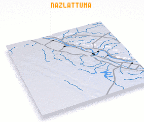 Places with similar names to Nazlat Tūmā, Egypt :: Disclaimer :: Information on this page comes without warranty of any kind |
||
|
Where is Nazlat Tūmā? Elevation and coordinates ::
Latitude (lat): 26°50'0"N Longitude (lon): 31°24'0"E
Elevation (approx.): 56m (map arrows pan, magnifying glasses zoom) |
||
|
Visiting Nazlat Tūmā? Hotel/Accommodation ::
Book a hotel in Nazlat Tūmā Travel Guide ::
Buy a travel guide for Egypt rental cars ::
car rental offers GPS waypoint ::
download a GPX waypoint (PoI) of Nazlat Tūmā for your GPS receiver
|
||