|
search place name
|
||
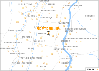
Şafţ Abū Jirj (Al Minyā, Egypt)Şafţ Abū Jirj is a town in the Al Minyā region of Egypt. An overview map of the region around Şafţ Abū Jirj is displayed below.
regional and 3d topo map of Şafţ Abū Jirj, Egypt ::
Şafţ Abū Jirj airports ::
The nearest airport is CAI - Cairo Intl, located 186.0 km north of Şafţ Abū Jirj.
Nearby towns ::
Abū Jirj (1.2km east) //
Abţūjah (2.4km west) //
Al Mawaddah (2.5km east) //
Abū al ‘Abbās (3.0km west) //
‘Izbat Ḩusayn ‘Abd ar Rāziq (3.1km east) //
Ţanbū (3.9km south) //
U‘ţū al Waqf (3.8km north west) //
Banī Mazār (4.4km south east) //
Minshāt Bakīr (4.8km south west) //
Nazlat Jalf (4.7km south west) //
Abā al Waqf (5.6km north) //
Umm as Sās (5.4km south west) //
Al Jundīyah (6.1km north east) //
Ibshāq al Ghazāl (6.5km south) //
Al Manshīyah al Jadīdah (6.5km south) //
Al ‘Abbāsīyah al Jadīdah (6.6km north east) //
Al Qays (7.0km south) //
Banī Sāmiţ (6.4km south east) //
Shulqām (6.6km west) //
Nazlat Dahrūţ (7.4km north) //
Nazlat ad Dalīl (7.5km south east) //
Al Jarābī‘ (6.9km east) //
Kafr ash Shaykh Anas (7.6km north west) //
As Sa‘dīyah (7.9km south) //
Dahrūţ (8.1km north) //
Ishnīn an Naşārá (8.3km north) //
Nazlet Aulâd Dura (8.2km south) //
Ashrūbah (7.6km west) //
Nazlat Aḩmad Yūnus (8.5km north west) //
[all distances 'as the bird flies' and approximate] 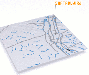 Places with similar names to Şafţ Abū Jirj, Egypt :: Disclaimer :: Information on this page comes without warranty of any kind |
||
|
Where is Şafţ Abū Jirj? Elevation and coordinates ::
Latitude (lat): 28°32'15"N Longitude (lon): 30°46'30"E
Elevation (approx.): 36m (map arrows pan, magnifying glasses zoom) |
||
|
Visiting Şafţ Abū Jirj? Hotel/Accommodation ::
Book a hotel in Şafţ Abū Jirj Travel Guide ::
Buy a travel guide for Egypt rental cars ::
car rental offers GPS waypoint ::
download a GPX waypoint (PoI) of Şafţ Abū Jirj for your GPS receiver
|
||