|
search place name
|
||
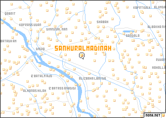
Sanhūr al Madīnah (Kafr ash Shaykh, Egypt)Sanhūr al Madīnah is a town in the Kafr ash Shaykh region of Egypt. An overview map of the region around Sanhūr al Madīnah is displayed below.
regional and 3d topo map of Sanhūr al Madīnah, Egypt ::
Sanhūr al Madīnah airports ::
The nearest airport is ALY - Alexandria Intl, located 74.9 km west of Sanhūr al Madīnah.
Other airports nearby include CAI - Cairo Intl (128.1 km south east), PSD - Port Said (144.9 km east), Nearby towns ::
Kafr Umm Yūsuf (2.3km east) //
‘Izbat Aḩmad aţ Ţūbjī (2.9km north) //
‘Izbat Ḩawḑ al Ḩajar (2.8km north west) //
Ash Shaykh Salāmah (2.9km south west) //
Minshāt Baţţāḩ (2.7km north east) //
‘Izbat al Biţāwī (2.6km west) //
‘Izbat al Ḩayţah (3.0km north east) //
Shabās ash Shuhadāʼ (3.5km south) //
‘Izbat ‘Abd al Jalīl (3.9km north) //
‘Izbat al Qaffāşah (3.5km west) //
‘Izbat al Mistikāwī (3.9km north east) //
Abyūqā (4.2km north) //
Dimīnkah (4.3km south west) //
‘Izbat al Janbīyah (4.1km north east) //
‘Izbat Muḩammad ad Daqdūqī (4.7km north) //
‘Izbat ‘Abd al Jawwād (4.3km north west) //
‘Izbat Badr ad Dīn (4.2km north east) //
Kafr Majar (4.7km south west) //
‘Izbat ‘Abd ar Raḩmān (4.5km north east) //
Al Ghunaymī (4.3km east) //
Maḩallat Abū ‘Alī al Gharbīyah (4.5km south west) //
‘Izbat Sulaymān Wahbah (4.3km west) //
‘Izbat ‘Abd al Karīm Abū Raʼs (4.9km north west) //
‘Izbat Yūsuf ash Sharnūbī (4.7km north east) //
‘Izbat Yaḩyá (4.9km north east) //
Al ‘Ajūzayn (5.3km north east) //
‘Izbat al Fār al Qiblīyah (5.2km north west) //
‘Izbat Muḩammad ‘Awn (5.8km north) //
Jamjamūn (5.1km west) //
[all distances 'as the bird flies' and approximate]  Places with similar names to Sanhūr al Madīnah, Egypt :: Disclaimer :: Information on this page comes without warranty of any kind |
||
|
Where is Sanhūr al Madīnah? Elevation and coordinates ::
Latitude (lat): 31°7'10"N Longitude (lon): 30°43'52"E
Elevation (approx.): 9m (map arrows pan, magnifying glasses zoom) |
||
|
Visiting Sanhūr al Madīnah? Hotel/Accommodation ::
Book a hotel in Sanhūr al Madīnah Travel Guide ::
Buy a travel guide for Egypt rental cars ::
car rental offers GPS waypoint ::
download a GPX waypoint (PoI) of Sanhūr al Madīnah for your GPS receiver
|
||