|
search place name
|
||
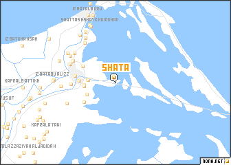
Shaṭa (Dumyāţ, Egypt)Shaṭa is a town in the Dumyāţ region of Egypt. An overview map of the region around Shaṭa is displayed below.
regional and 3d topo map of Shaṭa, Egypt ::
Shaṭa airports ::
The nearest airport is PSD - Port Said, located 37.7 km south east of Shaṭa.
Other airports nearby include CAI - Cairo Intl (149.7 km south), ALY - Alexandria Intl (185.0 km west), Nearby towns ::
Shaţţ Ghayţ an Naşārá (3.8km west) //
Ibrâhîm Ḥakîm (3.8km west) //
‘Izbat al Barbīr (4.4km south west) //
Al Ḩasāinah (4.3km west) //
As Sayyālah (4.4km west) //
Al ‘Awādilīyah (5.0km west) //
Shaṭṭ Gireiba (5.3km north west) //
Khārij ar Raswah (5.4km south west) //
Dumyāţ (5.7km west) //
Al Minyah (6.1km west) //
Al Buşaylah (6.8km north west) //
Shaṭṭ `Ezbet el-Laḥm (6.9km north west) //
‘Izbat Ţabl (7.7km north west) //
‘Izbat al Khayyāţah (7.4km north west) //
‘Izbat al ‘Awwām (7.5km north west) //
‘Izab al Başāriţah (7.5km south west) //
‘Izbat ar Raţmah (8.3km north west) //
‘Izbat ash Sharāyid (8.1km north west) //
Ash Shaykh Ḑirghām (9.2km north west) //
‘Izbat al Jirabī (9.1km north west) //
[all distances 'as the bird flies' and approximate]  Places with similar names to Shaṭa, Egypt ::
Disclaimer :: Information on this page comes without warranty of any kind |
||
|
Where is Shaṭa? Elevation and coordinates ::
Latitude (lat): 31°24'37"N Longitude (lon): 31°52'26"E
Elevation (approx.): 3m (map arrows pan, magnifying glasses zoom) |
||
|
Visiting Shaṭa? Hotel/Accommodation ::
Book a hotel in Shaṭa Travel Guide ::
Buy a travel guide for Egypt rental cars ::
car rental offers GPS waypoint ::
download a GPX waypoint (PoI) of Shaṭa for your GPS receiver
|
||