|
search place name
|
||
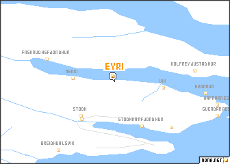
Eyri (Suður-Múlasýsla, Iceland)Eyri is a town in the Suður-Múlasýsla region of Iceland. An overview map of the region around Eyri is displayed below.
regional and 3d topo map of Eyri, Iceland ::
Eyri airports ::
The nearest airport is EGS - Egilsstadir, located 48.4 km north west of Eyri.
Other airports nearby include HFN - Hofn Hornafjordur (92.1 km south west), Nearby towns ::
Merki (3.0km west) //
Stöð (6.0km south west) //
Vík (3.5km east) //
Háteigur (6.5km south) //
Stöðvarfjörður (7.5km south) //
[all distances 'as the bird flies' and approximate] 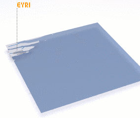 Places with similar names to Eyri, Iceland ::
Disclaimer :: Information on this page comes without warranty of any kind |
||
|
Where is Eyri? Elevation and coordinates ::
Latitude (lat): 64°54'0"N Longitude (lon): 13°55'0"W
(map arrows pan, magnifying glasses zoom) |
||
|
Visiting Eyri? Hotel/Accommodation ::
Book a hotel in Eyri Travel Guide ::
Buy a travel guide for Iceland rental cars ::
car rental offers GPS waypoint ::
download a GPX waypoint (PoI) of Eyri for your GPS receiver
|
||