|
search place name
|
||
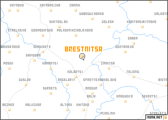
Brestnitsa (Bulgaria)Brestnitsa is a town in Bulgaria. An overview map of the region around Brestnitsa is displayed below.
regional and 3d topo map of Brestnitsa, Bulgaria ::
Brestnitsa airports ::
The nearest airport is VAR - Varna, located 75.3 km south of Brestnitsa.
Other airports nearby include CND - Constanta Mihail Kogalniceanu (91.0 km north east), BBU - Bucharest Aurel Vlaicu (135.8 km north west), OTP - Bucharest Henri Coanda (139.8 km north west), BOJ - Bourgas Burgas (146.0 km south), Nearby towns ::
Kolartsi (3.9km south) //
Zimnitsa (4.4km south east) //
Polkovnik-Cholakovo (5.7km north) //
Efreytor-Bakalovo (6.2km south east) //
Angelariy (6.2km south west) //
Onogur (7.5km south) //
Kamentsi (5.7km west) //
Golesh (8.4km north east) //
Svetoslav (8.4km north west) //
Sŭrnets (9.1km south west) //
[all distances 'as the bird flies' and approximate] 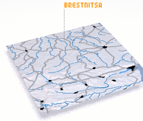 Places with similar names to Brestnitsa, Bulgaria ::
// Brestnitsa (BG)
Disclaimer :: Information on this page comes without warranty of any kind |
||
|
Where is Brestnitsa? Elevation and coordinates ::
Latitude (lat): 43°53'0"N Longitude (lon): 27°34'0"E
Elevation (approx.): 192m (map arrows pan, magnifying glasses zoom) |
||
|
Visiting Brestnitsa? Hotel/Accommodation ::
Book a hotel in Brestnitsa Travel Guide ::
Buy a travel guide for Bulgaria rental cars ::
car rental offers GPS waypoint ::
download a GPX waypoint (PoI) of Brestnitsa for your GPS receiver
|
||