|
search place name
|
||
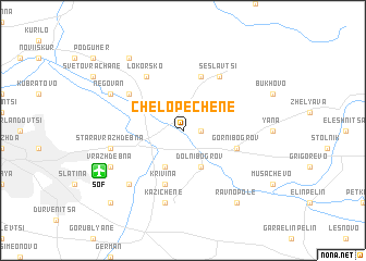
Chelopechene (Bulgaria)Chelopechene is a town in Bulgaria. An overview map of the region around Chelopechene is displayed below.
regional and 3d topo map of Chelopechene, Bulgaria ::
Chelopechene airports ::
The nearest airport is SOF - Sofia, located 7.6 km south west of Chelopechene.
Other airports nearby include PDV - Plovdiv (134.7 km south east), INI - Nis (148.8 km north west), SKP - Skopje (175.7 km south west), CRA - Craiova (179.1 km north), Nearby towns ::
Botunets (1.4km east) //
Katsilyane (3.9km south) //
Dolni Bogrov (3.9km south) //
Krivina (5.7km south) //
Gorni Bogrov (4.5km south east) //
Kremikovtsi (5.7km north) //
Lokorsko (6.2km north west) //
Seslavtsi (6.2km north east) //
Chepintsi (5.5km north west) //
Kazichene (7.5km south) //
Stara Vrazhdebna (5.8km west) //
Busmantsi (6.9km south west) //
Vrazhdebna (6.6km south west) //
Nova Vrazhdebna (6.6km south west) //
Negovan (6.6km north west) //
Ravno Pole (8.5km south east) //
Voynegovtsi (8.5km north west) //
Gara Iskŭr (9.2km south west) //
[all distances 'as the bird flies' and approximate]  Places with similar names to Chelopechene, Bulgaria ::
// Chelopechene (BG)
Disclaimer :: Information on this page comes without warranty of any kind |
||
|
Where is Chelopechene? Elevation and coordinates ::
Latitude (lat): 42°44'0"N Longitude (lon): 23°29'0"E
Elevation (approx.): 539m (map arrows pan, magnifying glasses zoom) |
||
|
Visiting Chelopechene? Hotel/Accommodation ::
Book a hotel in Chelopechene Travel Guide ::
Buy a travel guide for Bulgaria rental cars ::
car rental offers GPS waypoint ::
download a GPX waypoint (PoI) of Chelopechene for your GPS receiver
|
||