|
search place name
|
||
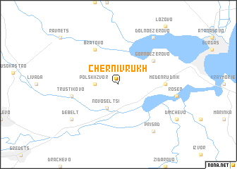
Cherni Vrŭkh (Bulgaria)Cherni Vrŭkh is a town in Bulgaria. An overview map of the region around Cherni Vrŭkh is displayed below.
regional and 3d topo map of Cherni Vrŭkh, Bulgaria ::
Cherni Vrŭkh airports ::
The nearest airport is BOJ - Bourgas Burgas, located 20.0 km north east of Cherni Vrŭkh.
Other airports nearby include VAR - Varna (95.7 km north east), GOZ - Gorna Orechovica Gorna Oryahovitsa (153.8 km north west), IST - Istanbul Ataturk (204.8 km south east), AXD - Alexandroupolis Dimokritos (211.0 km south west), Nearby towns ::
Polski Izvor (2.7km west) //
Novoseltsi (4.0km south) //
Bratovo (6.2km north west) //
Gorno Ezerovo (5.5km north east) //
Meden Rudnik (5.5km east) //
Trŭstikovo (5.8km west) //
Debelt (7.8km south west) //
Dolno Ezerovo (8.5km north east) //
Prisad (8.5km south east) //
[all distances 'as the bird flies' and approximate] 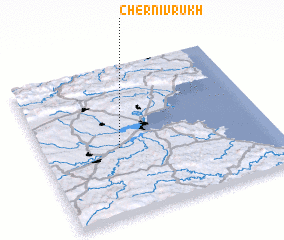 Places with similar names to Cherni Vrŭkh, Bulgaria ::
// Cherni Vrŭkh (BG)
// Cherni Vrŭkh (BG)
// Cherni Vrŭkh (BG)
// Cherni Vrŭkh (BG)
// Chernovrŭkh (BG)
// Chërnyy Verkh (RU)
// Chërnyy Vrag (RU)
Disclaimer :: Information on this page comes without warranty of any kind |
||
|
Where is Cherni Vrŭkh? Elevation and coordinates ::
Latitude (lat): 42°27'0"N Longitude (lon): 27°20'0"E
Elevation (approx.): 72m (map arrows pan, magnifying glasses zoom) |
||
|
Visiting Cherni Vrŭkh? Hotel/Accommodation ::
Book a hotel in Cherni Vrŭkh Travel Guide ::
Buy a travel guide for Bulgaria rental cars ::
car rental offers GPS waypoint ::
download a GPX waypoint (PoI) of Cherni Vrŭkh for your GPS receiver
|
||