|
search place name
|
||
Glogovitsa (Bulgaria)Glogovitsa is a town in Bulgaria. An overview map of the region around Glogovitsa is displayed below.
regional and 3d topo map of Glogovitsa, Bulgaria ::

Glogovitsa airports ::
The nearest airport is SOF - Sofia, located 61.4 km east of Glogovitsa.
Other airports nearby include INI - Nis (89.8 km north west), SKP - Skopje (126.2 km south west), PRN - Pristina (135.9 km west), CRA - Craiova (196.2 km north east), Nearby towns ::
Ezdimirtsi (2.9km north east) //
Velinovo (2.7km east) //
Busintsi (3.5km west) //
Bogoina (4.6km north) //
Trŭn (5.0km north) //
Milkʼovtsi (4.8km south east) //
Erul (6.3km south) //
Vukan (5.0km west) //
Kozhintsi (6.2km south west) //
Mramor (6.1km south west) //
Filipovtsi (5.8km north east) //
Studen Izvor (5.6km west) //
Turokovtsi (6.3km north west) //
Bankya (8.0km north) //
Berayntsi (6.1km west) //
Radovo (6.3km west) //
Paramun (6.4km east) //
Mraketintsi (6.8km east) //
Vrabcha (8.9km north) //
Banishte (9.2km south east) //
Butrointsi (9.2km north east) //
[all distances 'as the bird flies' and approximate] 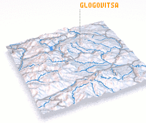 Places with similar names to Glogovitsa, Bulgaria ::
// Kalkvitz (DE)
// Glogovets (BG)
// Kalekovets (BG)
// Galaykovtsy (UA)
// Klokovitse (UA)
// Kulakovtse (UA)
Disclaimer :: Information on this page comes without warranty of any kind |
||
|
Where is Glogovitsa? Elevation and coordinates ::
Latitude (lat): 42°47'31"N Longitude (lon): 22°40'3"E
Elevation (approx.): 769m (map arrows pan, magnifying glasses zoom) |
||
|
Visiting Glogovitsa? Hotel/Accommodation ::
Book a hotel in Glogovitsa Travel Guide ::
Buy a travel guide for Bulgaria rental cars ::
car rental offers GPS waypoint ::
download a GPX waypoint (PoI) of Glogovitsa for your GPS receiver
|
||