|
search place name
|
||
Lukovit (Lovech, Bulgaria)Lukovit is a town in the Lovech region of Bulgaria. An overview map of the region around Lukovit is displayed below.
regional and 3d topo map of Lukovit, Bulgaria ::

Lukovit airports ::
The nearest airport is SOF - Sofia, located 83.6 km south west of Lukovit.
Other airports nearby include GOZ - Gorna Orechovica Gorna Oryahovitsa (125.8 km east), CRA - Craiova (126.2 km north), PDV - Plovdiv (137.7 km south east), BBU - Bucharest Aurel Vlaicu (212.6 km north east), Nearby towns ::
Todorichene (3.9km south) //
Petrevene (5.7km south) //
Rumyantsevo (7.5km south) //
Ruptsi (7.9km north) //
Dŭben (8.4km south east) //
Cherven Bryag (9.2km north west) //
Cherveni Bryag (9.2km north west) //
[all distances 'as the bird flies' and approximate] 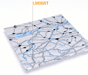 Places with similar names to Lukovit, Bulgaria ::
// Lokvata (BG)
// Lokvata (BG)
// La Cavada (ES)
// La Gaviota (CO)
// La Gaviota (CO)
// Lako Fioto (CD)
// La Cuevita (MX)
// La Queveda (VE)
// Léguéfétou (ML)
// La Gaveta (NI)
Disclaimer :: Information on this page comes without warranty of any kind |
||
|
Where is Lukovit? Elevation and coordinates ::
Latitude (lat): 43°12'0"N Longitude (lon): 24°10'0"E
Elevation (approx.): 136m (map arrows pan, magnifying glasses zoom) |
||
|
Visiting Lukovit? Hotel/Accommodation ::
Book a hotel in Lukovit Travel Guide ::
Buy a travel guide for Bulgaria rental cars ::
car rental offers GPS waypoint ::
download a GPX waypoint (PoI) of Lukovit for your GPS receiver
|
||