|
search place name
|
||
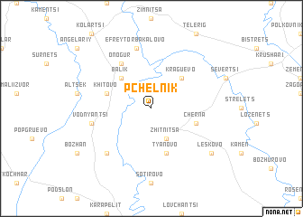
Pchelnik (Bulgaria)Pchelnik is a town in Bulgaria. An overview map of the region around Pchelnik is displayed below.
regional and 3d topo map of Pchelnik, Bulgaria ::
Pchelnik airports ::
The nearest airport is VAR - Varna, located 61.7 km south of Pchelnik.
Other airports nearby include CND - Constanta Mihail Kogalniceanu (96.2 km north east), BOJ - Bourgas Burgas (133.2 km south), BBU - Bucharest Aurel Vlaicu (146.2 km north west), OTP - Bucharest Henri Coanda (150.6 km north west), Nearby towns ::
Zhitnitsa (3.9km south) //
Kraguevo (4.6km north east) //
Balik (4.6km north west) //
Khitovo (4.4km north west) //
Tyanovo (5.7km south) //
Cherna (4.4km south east) //
Onogur (6.2km north west) //
Efreytor-Bakalovo (7.5km north) //
Vodnyantsi (5.7km west) //
Dryanovets (6.9km south west) //
Leskovo (7.7km south east) //
[all distances 'as the bird flies' and approximate]  Places with similar names to Pchelnik, Bulgaria ::
// Pichling (AT)
// Pichling (AT)
// Pchel'niki (RU)
// Pichilingue (EC)
// Pétialongo (GA)
// Pichilnque (MX)
// Pichilingo (PE)
// Pichilingue (PE)
// Pechelinga (MZ)
// Pchelʼniki (UA)
Disclaimer :: Information on this page comes without warranty of any kind |
||
|
Where is Pchelnik? Elevation and coordinates ::
Latitude (lat): 43°46'0"N Longitude (lon): 27°37'0"E
Elevation (approx.): 154m (map arrows pan, magnifying glasses zoom) |
||
|
Visiting Pchelnik? Hotel/Accommodation ::
Book a hotel in Pchelnik Travel Guide ::
Buy a travel guide for Bulgaria rental cars ::
car rental offers GPS waypoint ::
download a GPX waypoint (PoI) of Pchelnik for your GPS receiver
|
||