|
search place name
|
||
Antropova (Rēzeknes Rajons, Latvia)Antropova is a town in the Rēzeknes Rajons region of Latvia. An overview map of the region around Antropova is displayed below.
regional and 3d topo map of Antropova, Latvia ::
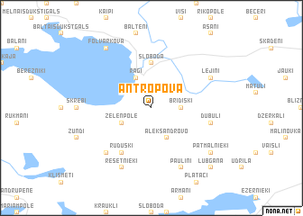
Nearby towns ::
Astici (2.1km north west) //
Bridišķi (2.1km east) //
Zeļenpole (2.8km south west) //
Aleksandrovo (3.8km south) //
Ragi (3.8km north) //
Sloboda (5.6km north) //
Kaunata (5.6km north) //
Ruduški (5.9km south) //
Mamonova (5.9km south) //
Dubuļi (4.5km south east) //
Ļoļi (6.4km south west) //
Resetnieki (7.7km south) //
Paulini (7.7km south) //
Lejiņi (5.5km north east) //
Foļvarkova (8.0km north west) //
Patmalnieki (6.9km south east) //
Lubgāna (8.5km south east) //
[all distances 'as the bird flies' and approximate] 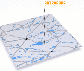 Places with similar names to Antropova, Latvia ::
Disclaimer :: Information on this page comes without warranty of any kind |
||
|
Where is Antropova? Elevation and coordinates ::
Latitude (lat): 56°17'0"N Longitude (lon): 27°32'0"E
Elevation (approx.): 177m (map arrows pan, magnifying glasses zoom) |
||
|
Visiting Antropova? Hotel/Accommodation ::
Book a hotel in Antropova Travel Guide ::
Buy a travel guide for Latvia rental cars ::
car rental offers GPS waypoint ::
download a GPX waypoint (PoI) of Antropova for your GPS receiver
|
||