|
search place name
|
||
Putnene (Tukuma Rajons, Latvia)Putnene is a town in the Tukuma Rajons region of Latvia. An overview map of the region around Putnene is displayed below.
regional and 3d topo map of Putnene, Latvia ::

Nearby towns ::
Viljete (2.1km south east) //
Daigone (4.2km south west) //
Cēre (4.2km north west) //
Pūre (5.6km south) //
Korģeļciems (5.7km north) //
Vecciems (5.9km north) //
Lamiņi (4.4km north east) //
Mūrmuiža (5.5km south east) //
Oksle (6.9km north west) //
Zvāre (6.9km south east) //
[all distances 'as the bird flies' and approximate] 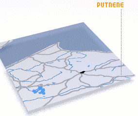 Places with similar names to Putnene, Latvia ::
// Pedinón (GR)
// Pedinón (GR)
// Podanin (PL)
// Podenii Noi (RO)
// Pataunan (ID)
// Potanino (KZ)
// (( Potanina )) (RU)
// Petunino (RU)
// Padaanan (PH)
// Podonino (RU)
Disclaimer :: Information on this page comes without warranty of any kind |
||
|
Where is Putnene? Elevation and coordinates ::
Latitude (lat): 57°5'0"N Longitude (lon): 22°54'0"E
Elevation (approx.): 82m (map arrows pan, magnifying glasses zoom) |
||
|
Visiting Putnene? Hotel/Accommodation ::
Book a hotel in Putnene Travel Guide ::
Buy a travel guide for Latvia rental cars ::
car rental offers GPS waypoint ::
download a GPX waypoint (PoI) of Putnene for your GPS receiver
|
||