|
search place name
|
||
Smiltene (Valkas Rajons, Latvia)Smiltene is a town in the Valkas Rajons region of Latvia. An overview map of the region around Smiltene is displayed below.
regional and 3d topo map of Smiltene, Latvia ::

Smiltene airports ::
The nearest airport is TLL - Tallinn-ulemiste International Tallinn, located 229.2 km north of Smiltene.
Nearby towns ::
Grotuži (1.0km west) //
Brutuļi (1.9km north) //
Cērtene (2.1km south west) //
Smiltenes Muiža (2.1km north east) //
Jaunbilska (2.1km north east) //
Silva (2.7km south east) //
Lembis (4.2km south west) //
Brūkši (5.6km south) //
Kurmis (4.4km south west) //
Eķītes (7.7km south) //
Ķīši (7.7km north) //
Brīkūzis (5.4km south west) //
Bilska (6.8km north east) //
[all distances 'as the bird flies' and approximate] 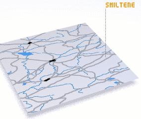 Places with similar names to Smiltene, Latvia ::
// Sawmill Town (US)
// Smilden (NO)
// Šmėltynė (LT)
// Smiltynai (LT)
// Smiltynė (LT)
// Smiltynė (LT)
// Smaltāni (LV)
// Smiltiņi (LV)
// Cemalettin (TR)
// Cemalettin (TR)
Disclaimer :: Information on this page comes without warranty of any kind |
||
|
Where is Smiltene? Elevation and coordinates ::
Latitude (lat): 57°26'0"N Longitude (lon): 25°54'0"E
Elevation (approx.): 83m (map arrows pan, magnifying glasses zoom) |
||
|
Visiting Smiltene? Hotel/Accommodation ::
Book a hotel in Smiltene Travel Guide ::
Buy a travel guide for Latvia rental cars ::
car rental offers GPS waypoint ::
download a GPX waypoint (PoI) of Smiltene for your GPS receiver
|
||