|
search place name
|
||
Stāmeriena (Gulbenes Rajons, Latvia)Stāmeriena is a town in the Gulbenes Rajons region of Latvia. An overview map of the region around Stāmeriena is displayed below.
regional and 3d topo map of Stāmeriena, Latvia ::
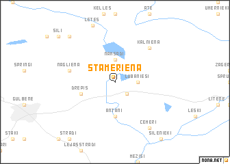
Nearby towns ::
Pogas (2.1km south east) //
Namsadi (3.7km north) //
Vecstāmeriena (2.0km east) //
Lubānieši (2.0km east) //
Antani (5.6km south) //
Drepis (3.5km south west) //
Nagliena (4.4km north west) //
Kalniena (6.3km north east) //
Cemeri (8.0km south) //
Plankukalni (8.4km north west) //
[all distances 'as the bird flies' and approximate] 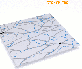 Places with similar names to Stāmeriena, Latvia ::
// Stemmern (DE)
// Sottomarina (IT)
// Stumbrinė (LT)
// Stomorine (BA)
// Seyyed Mīrān (IR)
// Sidi Amrane (DZ)
// Sidi Merouane (DZ)
// Sidi Merouane (DZ)
// Sidi Mérouane (DZ)
// Stambourne (GB)
Disclaimer :: Information on this page comes without warranty of any kind |
||
|
Where is Stāmeriena? Elevation and coordinates ::
Latitude (lat): 57°13'0"N Longitude (lon): 26°53'0"E
Elevation (approx.): 129m (map arrows pan, magnifying glasses zoom) |
||
|
Visiting Stāmeriena? Hotel/Accommodation ::
Book a hotel in Stāmeriena Travel Guide ::
Buy a travel guide for Latvia rental cars ::
car rental offers GPS waypoint ::
download a GPX waypoint (PoI) of Stāmeriena for your GPS receiver
|
||