|
search place name
|
||
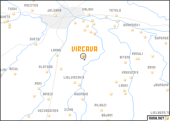
Vircava (Dobeles Rajons, Latvia)Vircava is a town in the Dobeles Rajons region of Latvia. An overview map of the region around Vircava is displayed below.
regional and 3d topo map of Vircava, Latvia ::
Nearby towns ::
Lielvircava (5.0km south) //
Pēterlauki (3.4km south west) //
Raiņi (5.5km south) //
Blukas (6.0km north) //
Lapas (3.6km west) //
(( Vadži )) (6.4km north) //
Mežciems (6.8km north) //
Lediņi (7.6km north) //
Kārniņi (8.1km north) //
Liepare (6.1km south east) //
(( Audruve )) (8.5km south) //
Siera Muiža (8.4km north) //
Platone (5.3km south west) //
Rosiba (8.8km north) //
Bitēni (4.9km east) //
Vecsvirlaukas Muiža (8.9km north) //
Oglaine (8.0km south east) //
Mazlauki (6.5km south east) //
Pakuļi (8.5km north east) //
(( Lauki )) (8.2km south east) //
Tetele (9.6km north east) //
Roķi (8.7km south east) //
(( Brieži )) (9.7km south west) //
[all distances 'as the bird flies' and approximate] 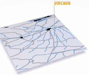 Places with similar names to Vircava, Latvia ::
Disclaimer :: Information on this page comes without warranty of any kind |
||
|
Where is Vircava? Elevation and coordinates ::
Latitude (lat): 56°33'35"N Longitude (lon): 23°46'19"E
Elevation (approx.): 7m (map arrows pan, magnifying glasses zoom) |
||
|
Visiting Vircava? Hotel/Accommodation ::
Book a hotel in Vircava Travel Guide ::
Buy a travel guide for Latvia rental cars ::
car rental offers GPS waypoint ::
download a GPX waypoint (PoI) of Vircava for your GPS receiver
|
||