|
search place name
|
||
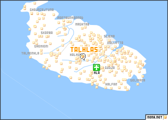
Tal-Ħlas (Malta)Tal-Ħlas is a town in Malta. An overview map of the region around Tal-Ħlas is displayed below.
regional and 3d topo map of Tal-Ħlas, Malta ::
Tal-Ħlas airports ::
The nearest airport is MLA - Malta Luqa, located 2.9 km south east of Tal-Ħlas.
Other airports nearby include LMP - Lampedusa (171.1 km west), NSY - Sigonella (174.8 km north), CTA - Catania Fontanarossa (185.2 km north), Nearby towns ::
Għar Ram (0.6km east) //
Ħal Mula (0.7km south west) //
Taʼ l-Infetti (0.7km west) //
Żebbuġ (1.0km west) //
It-Troll (1.1km south west) //
Il-Ħammieri (1.3km north east) //
Taʼ Srina (1.2km north west) //
Ħal Muxi (1.5km west) //
Tal-Ħandaq (1.5km east) //
Ħal Dwin (1.5km west) //
Attard (2.0km north west) //
L-Armier (1.7km east) //
Taʼ San Ġwakkin (2.0km north east) //
Qormi (1.9km east) //
Tas-Salvatur (2.5km south) //
Siġġiewi (2.4km south west) //
Birkirkara (2.8km north) //
Tal-Palazz l-Aħmar (2.6km north east) //
Fleur de Lys (2.7km north east) //
Taʼ Ħaxxluq (3.0km south) //
Tad-Dwieli (2.6km north east) //
L-Istabar (2.5km east) //
Balzan (3.0km north) //
Tas-Salib (2.9km north east) //
Tal-Mirakli (2.9km north west) //
Lija (3.1km north) //
Taʼ Kandja (3.0km south east) //
Ħalq Dieri (2.6km west) //
Santa Vennera (2.8km north east) //
[all distances 'as the bird flies' and approximate]  Places with similar names to Tal-Ħlas, Malta ::
Disclaimer :: Information on this page comes without warranty of any kind |
||
|
Where is Tal-Ħlas? Elevation and coordinates ::
Latitude (lat): 35°52'23"N Longitude (lon): 14°27'6"E
Elevation (approx.): 91m (map arrows pan, magnifying glasses zoom) |
||
|
Visiting Tal-Ħlas? Hotel/Accommodation ::
Book a hotel in Tal-Ħlas Travel Guide ::
Buy a travel guide for Malta rental cars ::
car rental offers GPS waypoint ::
download a GPX waypoint (PoI) of Tal-Ħlas for your GPS receiver
|
||