|
search place name
|
||
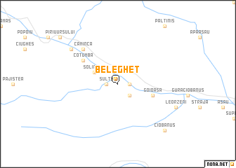
Beleghet (Covurlui, Romania)Beleghet is a town in the Covurlui region of Romania. An overview map of the region around Beleghet is displayed below.
regional and 3d topo map of Beleghet, Romania ::
Beleghet airports ::
The nearest airport is BCM - Bacau, located 51.1 km east of Beleghet.
Other airports nearby include IAS - Iasi (131.1 km north east), SCV - Suceava Stefan Cel Mare (136.0 km north), TGM - Tirgu Mures Vidrasau (141.1 km west), OTP - Bucharest Henri Coanda (210.9 km south), Nearby towns ::
Diaconeşti (1.3km east) //
Sulţa (1.3km west) //
Preluci (2.3km south east) //
Agăş (3.2km north west) //
Pîrîu Agăş (3.2km north west) //
Simbrea (3.2km north west) //
Solintari (3.2km north west) //
Goioasa (4.3km south east) //
Cotumba (5.3km north west) //
Camînca (6.8km north west) //
Burueniş (6.8km north west) //
Brusturoasa (6.8km north west) //
Burueniş de Sus (7.5km north west) //
Ciobănuş (9.0km south east) //
[all distances 'as the bird flies' and approximate]  Places with similar names to Beleghet, Romania ::
// Balighot (PH)
// Bele Vode (BA)
// Bela Voda (BG)
// Belovod (UA)
// Bilovody (UA)
// Belaftū (IR)
// Baliāghāt (BD)
// Bāliāghāta (BD)
// Bālughāt (BD)
// Bāuliāghāta (BD)
Disclaimer :: Information on this page comes without warranty of any kind |
||
|
Where is Beleghet? Elevation and coordinates ::
Latitude (lat): 46°28'0"N Longitude (lon): 26°15'0"E
Elevation (approx.): 585m (map arrows pan, magnifying glasses zoom) |
||
|
Visiting Beleghet? Hotel/Accommodation ::
Book a hotel in Beleghet Travel Guide ::
Buy a travel guide for Romania rental cars ::
car rental offers GPS waypoint ::
download a GPX waypoint (PoI) of Beleghet for your GPS receiver
|
||