|
search place name
|
||
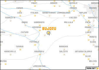
Bujoru (Covurlui, Romania)Bujoru is a town in the Covurlui region of Romania. An overview map of the region around Bujoru is displayed below.
regional and 3d topo map of Bujoru, Romania ::
Bujoru airports ::
The nearest airport is CRA - Craiova, located 21.3 km north east of Bujoru.
Other airports nearby include CSB - Caransebes (172.0 km north west), SOF - Sofia (172.0 km south), INI - Nis (175.5 km south west), SBZ - Sibiu (176.0 km north), Nearby towns ::
Vîrvoru (1.3km west) //
Vîrvoru de Jos (3.2km north west) //
Criva (3.2km north west) //
Dobromira (4.6km north west) //
Fîntînele (5.4km south west) //
Sărbătoarea (7.4km north) //
Panaghia (6.8km south east) //
Radovanu (7.9km south) //
Palilula (6.5km north east) //
Sălcuţa (8.4km south east) //
Italieni (8.4km north west) //
Leamna de Sus (8.4km north east) //
[all distances 'as the bird flies' and approximate] 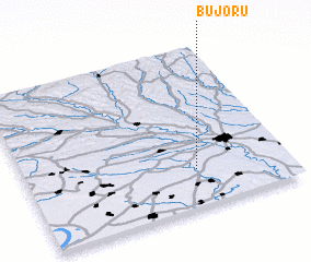 Places with similar names to Bujoru, Romania ::
Disclaimer :: Information on this page comes without warranty of any kind |
||
|
Where is Bujoru? Elevation and coordinates ::
Latitude (lat): 44°14'0"N Longitude (lon): 23°39'0"E
Elevation (approx.): 162m (map arrows pan, magnifying glasses zoom) |
||
|
Visiting Bujoru? Hotel/Accommodation ::
Book a hotel in Bujoru Travel Guide ::
Buy a travel guide for Romania rental cars ::
car rental offers GPS waypoint ::
download a GPX waypoint (PoI) of Bujoru for your GPS receiver
|
||