|
search place name
|
||
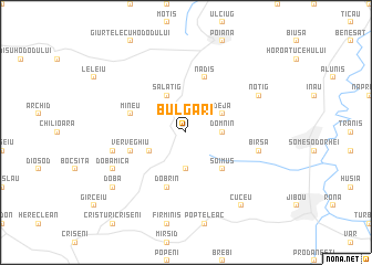
Bulgari (Covurlui, Romania)Bulgari is a town in the Covurlui region of Romania. An overview map of the region around Bulgari is displayed below.
regional and 3d topo map of Bulgari, Romania ::
Bulgari airports ::
The nearest airport is BAY - Baia Mare Tautii Magheraus, located 43.4 km north east of Bulgari.
Other airports nearby include SUJ - Satu Mare (45.7 km north west), CLJ - Cluj-napoca Cluj Napoca (73.3 km south east), OMR - Oradea (100.6 km west), DEB - Debrecen (117.1 km west), Nearby towns ::
Sîncraiu Silvaniei (3.7km south) //
Domnin (2.5km east) //
Naimon (3.1km south west) //
Deja (3.1km north east) //
Sălăţig (3.9km north) //
Şoimuş (4.5km south east) //
Verveghiu (4.2km south west) //
Dobrin (5.7km south) //
Mineu (4.2km north west) //
Nadiş (5.7km north) //
Deleni (5.4km west) //
Bîrsa (5.4km east) //
Doba Mică (6.2km south west) //
Noţig (6.2km north east) //
Cuceu (8.3km south east) //
Doba (7.5km south west) //
[all distances 'as the bird flies' and approximate] 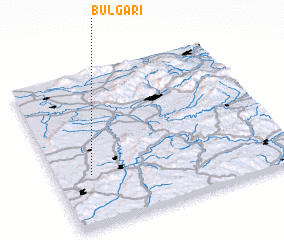 Places with similar names to Bulgari, Romania ::
// Bleecker (US)
// Byhleguhre (DE)
// Blocker (US)
// Bulgaria (IT)
// Boligueira (PT)
// Biała Góra (PL)
// Biała Góra (PL)
// Biała Góra (PL)
// Białogóra (PL)
// Białogóry (PL)
Disclaimer :: Information on this page comes without warranty of any kind |
||
|
Where is Bulgari? Elevation and coordinates ::
Latitude (lat): 47°20'0"N Longitude (lon): 23°9'0"E
Elevation (approx.): 256m (map arrows pan, magnifying glasses zoom) |
||
|
Visiting Bulgari? Hotel/Accommodation ::
Book a hotel in Bulgari Travel Guide ::
Buy a travel guide for Romania rental cars ::
car rental offers GPS waypoint ::
download a GPX waypoint (PoI) of Bulgari for your GPS receiver
|
||