|
search place name
|
||
Cârtojanca (Teleorman, Romania)Cârtojanca is a town in the Teleorman region of Romania. An overview map of the region around Cârtojanca is displayed below.
regional and 3d topo map of Cârtojanca, Romania ::

Cârtojanca airports ::
The nearest airport is BBU - Bucharest Aurel Vlaicu, located 52.4 km north east of Cârtojanca.
Other airports nearby include OTP - Bucharest Henri Coanda (56.6 km north east), GOZ - Gorna Orechovica Gorna Oryahovitsa (124.8 km south), CRA - Craiova (131.4 km west), SBZ - Sibiu (203.5 km north west), Nearby towns ::
Stănceasca (0.0km north) //
Videle (1.5km north west) //
Furculeşti (1.3km west) //
Cuza Vodă (1.3km west) //
Tămăşeşti (1.3km east) //
Răduleşti (2.9km south east) //
Spâneşti (2.7km east) //
Fotăcheşti (3.2km north west) //
Pariseşti (4.0km east) //
Crevenicu Mare (5.4km south east) //
Crevenicu (5.3km south east) //
Moşteni (8.1km south) //
Blejeşti (6.5km north west) //
[all distances 'as the bird flies' and approximate] 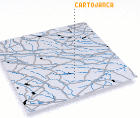 Places with similar names to Cârtojanca, Romania :: Disclaimer :: Information on this page comes without warranty of any kind |
||
|
Where is Cârtojanca? Elevation and coordinates ::
Latitude (lat): 44°16'0"N Longitude (lon): 25°32'0"E
Elevation (approx.): 90m (map arrows pan, magnifying glasses zoom) |
||
|
Visiting Cârtojanca? Hotel/Accommodation ::
Book a hotel in Cârtojanca Travel Guide ::
Buy a travel guide for Romania rental cars ::
car rental offers GPS waypoint ::
download a GPX waypoint (PoI) of Cârtojanca for your GPS receiver
|
||