|
search place name
|
||
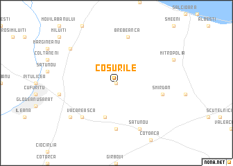
Coşurile (Covurlui, Romania)Coşurile is a town in the Covurlui region of Romania. An overview map of the region around Coşurile is displayed below.
regional and 3d topo map of Coşurile, Romania ::
Coşurile airports ::
The nearest airport is OTP - Bucharest Henri Coanda, located 64.0 km south west of Coşurile.
Other airports nearby include BBU - Bucharest Aurel Vlaicu (68.7 km south west), CND - Constanta Mihail Kogalniceanu (149.1 km south east), TCE - Tulcea Cataloi (154.7 km east), BCM - Bacau (180.6 km north), Nearby towns ::
Florica (NaNkm north) //
Cîrligu Mare (5.7km south) //
Corbu (5.7km south) //
Cîrligu Mic (7.4km south) //
Smîrdan (5.6km east) //
Brebeanca (7.5km north) //
Văcăreasca (6.8km south west) //
Glodeanu-Siliştea (7.9km south) //
Satu Nou (7.9km south) //
Casota (7.6km south west) //
Limpezişu (7.6km north west) //
[all distances 'as the bird flies' and approximate]  Places with similar names to Coşurile, Romania ::
// Qaysarlı (AZ)
// Casa Reali (IT)
// Casa Riola (IT)
// Casarola (IT)
// Cassaurolo (IT)
// Czuryły (PL)
// Căscioarele (RO)
// Căscioarele (RO)
// Căscioarele (RO)
// Căscioarele (RO)
Disclaimer :: Information on this page comes without warranty of any kind |
||
|
Where is Coşurile? Elevation and coordinates ::
Latitude (lat): 44°54'0"N Longitude (lon): 26°46'0"E
Elevation (approx.): 81m (map arrows pan, magnifying glasses zoom) |
||
|
Visiting Coşurile? Hotel/Accommodation ::
Book a hotel in Coşurile Travel Guide ::
Buy a travel guide for Romania rental cars ::
car rental offers GPS waypoint ::
download a GPX waypoint (PoI) of Coşurile for your GPS receiver
|
||