|
search place name
|
||
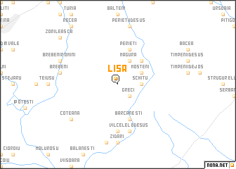
Lisa (Covurlui, Romania)Lisa is a town in the Covurlui region of Romania. An overview map of the region around Lisa is displayed below.
regional and 3d topo map of Lisa, Romania ::
Lisa airports ::
The nearest airport is CRA - Craiova, located 51.5 km west of Lisa.
Other airports nearby include BBU - Bucharest Aurel Vlaicu (126.1 km east), OTP - Bucharest Henri Coanda (127.3 km east), SBZ - Sibiu (163.3 km north), GOZ - Gorna Orechovica Gorna Oryahovitsa (163.6 km south east), Nearby towns ::
Greci (2.3km south east) //
Schitu (2.7km east) //
Măgura (3.9km north) //
Moşteni (3.2km north east) //
Catanele (4.6km north east) //
Mierleştii de Sus (5.7km north) //
Perieţi (5.7km north) //
Bărcăneşti (5.7km south) //
Vîlcele (7.4km south) //
Vîlcelele de Sus (7.5km south) //
Dealu Mare (7.5km south) //
Liceşti (7.5km south) //
Măndineşti (7.5km south) //
Olteni (7.5km south) //
Badia (7.5km south) //
Coteana (7.7km south west) //
[all distances 'as the bird flies' and approximate] 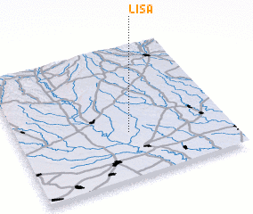 Places with similar names to Lisa, Romania ::
Disclaimer :: Information on this page comes without warranty of any kind |
||
|
Where is Lisa? Elevation and coordinates ::
Latitude (lat): 44°21'0"N Longitude (lon): 24°32'0"E
Elevation (approx.): 170m (map arrows pan, magnifying glasses zoom) |
||
|
Visiting Lisa? Hotel/Accommodation ::
Book a hotel in Lisa Travel Guide ::
Buy a travel guide for Romania rental cars ::
car rental offers GPS waypoint ::
download a GPX waypoint (PoI) of Lisa for your GPS receiver
|
||