|
search place name
|
||
Peretu (Covurlui, Romania)Peretu is a town in the Covurlui region of Romania. An overview map of the region around Peretu is displayed below.
regional and 3d topo map of Peretu, Romania ::

Peretu airports ::
The nearest airport is CRA - Craiova, located 13.3 km north east of Peretu.
Other airports nearby include SOF - Sofia (172.0 km south), SBZ - Sibiu (175.9 km north), CSB - Caransebes (181.2 km north west), INI - Nis (184.6 km south west), Nearby towns ::
Glodu (1.9km south) //
Gura Văii (1.3km west) //
Livezi (2.3km north west) //
Jiul (2.7km east) //
Podari (3.9km north) //
Ţuglui (3.9km south) //
Balta Verde (5.6km north) //
Braniştea (5.7km north) //
Făcăi (5.7km north) //
Satu Nou Calopăr (6.2km south west) //
Calopăru (6.2km south west) //
Malu Mic (5.4km north east) //
Romîneşti (7.4km north) //
Popoveni (7.5km north) //
Malu Mare (5.6km east) //
Secuiu (5.6km east) //
Dîlga (7.5km south) //
Preajba (6.8km north east) //
Bîzdîna (7.9km south) //
Pescari (7.7km south east) //
Miculeşti (7.7km south east) //
Teascu (7.7km south east) //
Cîrligei (9.1km north west) //
Gloduţ (9.1km south east) //
[all distances 'as the bird flies' and approximate] 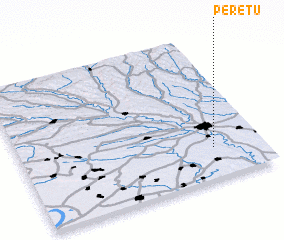 Places with similar names to Peretu, Romania ::
Disclaimer :: Information on this page comes without warranty of any kind |
||
|
Where is Peretu? Elevation and coordinates ::
Latitude (lat): 44°13'0"N Longitude (lon): 23°48'0"E
Elevation (approx.): 67m (map arrows pan, magnifying glasses zoom) |
||
|
Visiting Peretu? Hotel/Accommodation ::
Book a hotel in Peretu Travel Guide ::
Buy a travel guide for Romania rental cars ::
car rental offers GPS waypoint ::
download a GPX waypoint (PoI) of Peretu for your GPS receiver
|
||