|
search place name
|
||
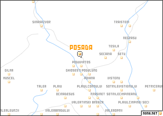
Posada (Covurlui, Romania)Posada is a town in the Covurlui region of Romania. An overview map of the region around Posada is displayed below.
regional and 3d topo map of Posada, Romania ::
Posada airports ::
The nearest airport is OTP - Bucharest Henri Coanda, located 87.3 km south east of Posada.
Other airports nearby include BBU - Bucharest Aurel Vlaicu (94.3 km south east), SBZ - Sibiu (132.7 km north west), TGM - Tirgu Mures Vidrasau (162.2 km north west), BCM - Bacau (169.6 km north east), Nearby towns ::
Podu Vîrtos (1.9km south) //
Podu lui Neag (2.3km south west) //
Comarnic (3.7km south) //
Ghioşeşti (3.9km south) //
Podu Lung (3.9km south) //
Secăria (3.9km east) //
Poiana (5.7km south) //
Podu Corbului (5.7km south) //
Plaiul Cornului (7.5km south) //
Teşila (5.5km east) //
Plaiu (8.4km south west) //
Visteru (7.6km south east) //
[all distances 'as the bird flies' and approximate] 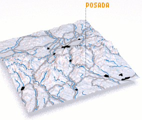 Places with similar names to Posada, Romania ::
Disclaimer :: Information on this page comes without warranty of any kind |
||
|
Where is Posada? Elevation and coordinates ::
Latitude (lat): 45°17'0"N Longitude (lon): 25°38'0"E
Elevation (approx.): 793m (map arrows pan, magnifying glasses zoom) |
||
|
Visiting Posada? Hotel/Accommodation ::
Book a hotel in Posada Travel Guide ::
Buy a travel guide for Romania rental cars ::
car rental offers GPS waypoint ::
download a GPX waypoint (PoI) of Posada for your GPS receiver
|
||