|
search place name
|
||
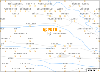
Şopotu (Covurlui, Romania)Şopotu is a town in the Covurlui region of Romania. An overview map of the region around Şopotu is displayed below.
regional and 3d topo map of Şopotu, Romania ::
Şopotu airports ::
The nearest airport is CRA - Craiova, located 32.9 km east of Şopotu.
Other airports nearby include CSB - Caransebes (148.7 km north west), SBZ - Sibiu (159.1 km north), INI - Nis (178.6 km south west), SOF - Sofia (191.4 km south), Nearby towns ::
Corniţa (2.3km north west) //
Rasnicu Bătrîn (2.6km east) //
Rasnicu Oghian (3.2km north east) //
Başcou (3.9km south) //
Petroaia (5.6km south) //
Valea lui Pătru (5.7km north) //
Beloţu (5.4km south east) //
Corbu (7.4km north) //
Frasinu (7.4km south) //
Cernat (5.6km west) //
Brăceni (6.8km south west) //
Milovan (6.8km south east) //
Sîrsca (6.8km south east) //
Ochişoru (7.9km north) //
Bucicani (7.9km south) //
Pleşoiu (7.9km south) //
Cernăteşti (6.5km north west) //
Pereni (6.5km south east) //
Urdiniţa (6.5km south west) //
Salcia (8.4km north west) //
Sfîrcea (8.4km north east) //
Brabova (7.7km south west) //
[all distances 'as the bird flies' and approximate] 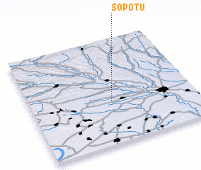 Places with similar names to Şopotu, Romania ::
Disclaimer :: Information on this page comes without warranty of any kind |
||
|
Where is Şopotu? Elevation and coordinates ::
Latitude (lat): 44°25'0"N Longitude (lon): 23°30'0"E
Elevation (approx.): 201m (map arrows pan, magnifying glasses zoom) |
||
|
Visiting Şopotu? Hotel/Accommodation ::
Book a hotel in Şopotu Travel Guide ::
Buy a travel guide for Romania rental cars ::
car rental offers GPS waypoint ::
download a GPX waypoint (PoI) of Şopotu for your GPS receiver
|
||