|
search place name
|
||
Stavropoleos (Covurlui, Romania)Stavropoleos is a town in the Covurlui region of Romania. An overview map of the region around Stavropoleos is displayed below.
regional and 3d topo map of Stavropoleos, Romania ::

Stavropoleos airports ::
The nearest airport is OTP - Bucharest Henri Coanda, located 59.7 km south east of Stavropoleos.
Other airports nearby include BBU - Bucharest Aurel Vlaicu (65.8 km south east), SBZ - Sibiu (149.1 km north west), CRA - Craiova (155.7 km south west), TGM - Tirgu Mures Vidrasau (189.7 km north west), Nearby towns ::
Pleaşa (1.3km west) //
Tisa (1.9km north) //
Ţuicani (2.3km south east) //
Moreni (2.6km east) //
Schela Mare (2.6km east) //
Cricovu Dulce (3.7km north) //
Colibaşi (5.6km north) //
Edera de Jos (5.7km north) //
Adînca (5.7km south) //
Capul Plaiului (5.4km south west) //
Gura Ocnitei (6.1km south west) //
Edera de Sus (7.4km north) //
Ocniţa (5.2km west) //
Ochiuri (6.8km south west) //
Ghirdoveni (6.8km south east) //
Gorgoteni (6.4km south west) //
Săcueni (8.4km south west) //
Valea Lungă-Ogrea (8.4km north west) //
[all distances 'as the bird flies' and approximate] 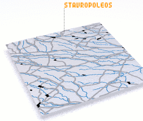 Places with similar names to Stavropoleos, Romania ::
// Stavroúpolis (GR)
// Stavroúpolis (GR)
Disclaimer :: Information on this page comes without warranty of any kind |
||
|
Where is Stavropoleos? Elevation and coordinates ::
Latitude (lat): 44°59'0"N Longitude (lon): 25°37'0"E
Elevation (approx.): 363m (map arrows pan, magnifying glasses zoom) |
||
|
Visiting Stavropoleos? Hotel/Accommodation ::
Book a hotel in Stavropoleos Travel Guide ::
Buy a travel guide for Romania rental cars ::
car rental offers GPS waypoint ::
download a GPX waypoint (PoI) of Stavropoleos for your GPS receiver
|
||