|
search place name
|
||
Valea Măgurii (Covurlui, Romania)Valea Măgurii is a town in the Covurlui region of Romania. An overview map of the region around Valea Măgurii is displayed below.
regional and 3d topo map of Valea Măgurii, Romania ::

Valea Măgurii airports ::
The nearest airport is TGM - Tirgu Mures Vidrasau, located 97.8 km south of Valea Măgurii.
Other airports nearby include CLJ - Cluj-napoca Cluj Napoca (100.1 km south west), BAY - Baia Mare Tautii Magheraus (103.7 km west), SCV - Suceava Stefan Cel Mare (127.7 km east), SUJ - Satu Mare (146.9 km west), Nearby towns ::
Lunca Leşului (0.0km north) //
Leşu (0.0km north) //
Poiana Ilvei (3.9km north) //
Măgura Ilvei (8.3km north east) //
Arşiţă (7.5km north east) //
Sîngeorz-Băi (7.5km north west) //
Tunel (7.5km north east) //
Valea Borcutului (7.5km north west) //
Cormaia (7.5km north west) //
[all distances 'as the bird flies' and approximate] 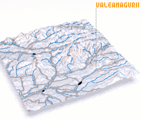 Places with similar names to Valea Măgurii, Romania ::
// Valea Măgurii (RO)
// Ghulām Kirio (PK)
// Valmaggiore (IT)
// Valmaggiore (IT)
// Villa Magri (IT)
// Villa Maggiore (IT)
// Villamaggiore (IT)
// Vilmaggiore (IT)
Disclaimer :: Information on this page comes without warranty of any kind |
||
|
Where is Valea Măgurii? Elevation and coordinates ::
Latitude (lat): 47°19'0"N Longitude (lon): 24°45'0"E
Elevation (approx.): 589m (map arrows pan, magnifying glasses zoom) |
||
|
Visiting Valea Măgurii? Hotel/Accommodation ::
Book a hotel in Valea Măgurii Travel Guide ::
Buy a travel guide for Romania rental cars ::
car rental offers GPS waypoint ::
download a GPX waypoint (PoI) of Valea Măgurii for your GPS receiver
|
||