|
search place name
|
||
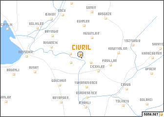
Çivril (Turkey)Çivril is a town in Turkey. An overview map of the region around Çivril is displayed below.
regional and 3d topo map of Çivril, Turkey ::
Çivril airports ::
The nearest airport is KYA - Konya, located 72.1 km north east of Çivril.
Other airports nearby include AYT - Antalya (126.0 km south west), AFY - Afyon (159.6 km north west), Nearby towns ::
Karahisar (1.9km south east) //
Bektemir (2.2km south west) //
Bayat (2.3km north west) //
Çiçekler (4.1km south east) //
Mesutlar (5.1km north) //
Yukarı Esence (6.5km south) //
Fasıllar (5.4km east) //
Avdancık (6.1km north west) //
Eğirler (7.5km north) //
Gökçimen (7.3km south west) //
Hüseyinler (6.7km east) //
Bayındır (7.5km north west) //
Aşağıesence (8.9km south) //
[all distances 'as the bird flies' and approximate] 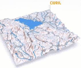 Places with similar names to Çivril, Turkey ::
Disclaimer :: Information on this page comes without warranty of any kind |
||
|
Where is Çivril? Elevation and coordinates ::
Latitude (lat): 37°40'19"N Longitude (lon): 31°50'25"E
Elevation (approx.): 1131m (map arrows pan, magnifying glasses zoom) |
||
|
Visiting Çivril? Hotel/Accommodation ::
Book a hotel in Çivril Travel Guide ::
Buy a travel guide for Turkey rental cars ::
car rental offers GPS waypoint ::
download a GPX waypoint (PoI) of Çivril for your GPS receiver
|
||