|
search place name
|
||
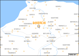
Dikencik (Samsun, Turkey)Dikencik is a town in the Samsun region of Turkey. An overview map of the region around Dikencik is displayed below.
regional and 3d topo map of Dikencik, Turkey ::
Dikencik airports ::
The nearest airport is MZH - Merzifon, located 107.0 km south west of Dikencik.
Other airports nearby include VAS - Sivas (160.7 km south), Nearby towns ::
Aşağıdikencik (1.5km north) //
Yukarıdikencik (1.4km east) //
Güneşli (1.4km west) //
Ahubaba (2.3km north west) //
Çelikli (3.7km south) //
Hacılıçay (2.8km east) //
Durakbaşı (4.0km north) //
Kuşhane (4.0km south) //
Yenikaracalı (3.8km west) //
Paşayazı (4.8km north) //
Beylerce (4.6km south east) //
Dikbıyık (4.6km south west) //
Köklük (4.2km east) //
Uluköy (4.6km north east) //
Saraçlı (5.7km south) //
Vakıfköprü (5.9km north) //
Ovacık (5.8km north west) //
Epçeli (5.4km west) //
Irmaksırtı (5.6km west) //
Kaçakavak (5.9km east) //
Aşıklı (7.0km south west) //
Sığırtmaç (6.7km north east) //
Nukusköy (8.3km north) //
Çarşamba (7.3km south east) //
Karabahçe (6.7km north west) //
Kumtepe (7.6km north west) //
Yeniyapı (8.7km north) //
Beyyenice (8.5km south east) //
Bayramlı (8.5km south west) //
[all distances 'as the bird flies' and approximate]  Places with similar names to Dikencik, Turkey ::
// Daukniškiai (LT)
// Takniškiai (LT)
// Doğancık (TR)
// Doğancik (TR)
// Teknecık (TR)
// Teknecik (TR)
// Tiguinzougué (BF)
Disclaimer :: Information on this page comes without warranty of any kind |
||
|
Where is Dikencik? Elevation and coordinates ::
Latitude (lat): 41°15'0"N Longitude (lon): 36°40'0"E
Elevation (approx.): 11m (map arrows pan, magnifying glasses zoom) |
||
|
Visiting Dikencik? Hotel/Accommodation ::
Book a hotel in Dikencik Travel Guide ::
Buy a travel guide for Turkey rental cars ::
car rental offers GPS waypoint ::
download a GPX waypoint (PoI) of Dikencik for your GPS receiver
|
||